

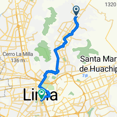
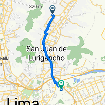
De Jirón los Claveles 628, Lima a WWJC+WPP, San Miguel
A cycling route starting in Independencia, Lima region, Peru.
Overview
About this route
- 42 min
- Duration
- 11.1 km
- Distance
- 64 m
- Ascent
- 65 m
- Descent
- 15.8 km/h
- Avg. speed
- 91 m
- Max. altitude

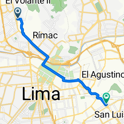
Route quality
Waytypes & surfaces along the route
Waytypes
Cycleway
8.8 km
(79 %)
Road
0.9 km
(8 %)
Surfaces
Paved
3 km
(27 %)
Asphalt
3 km
(27 %)
Undefined
8.1 km
(73 %)
Continue with Bikemap
Use, edit, or download this cycling route
You would like to ride De Jirón los Claveles 628, Lima a WWJC+WPP, San Miguel or customize it for your own trip? Here is what you can do with this Bikemap route:
Free features
- Save this route as favorite or in collections
- Copy & plan your own version of this route
- Sync your route with Garmin or Wahoo
Premium features
Free trial for 3 days, or one-time payment. More about Bikemap Premium.
- Navigate this route on iOS & Android
- Export a GPX / KML file of this route
- Create your custom printout (try it for free)
- Download this route for offline navigation
Discover more Premium features.
Get Bikemap PremiumFrom our community
Other popular routes starting in Independencia
 universidad usmp santa anita
- Distance
- 15.6 km
- Ascent
- 92 m
- Descent
- 128 m
- Location
- Independencia, Lima region, Peru
 a el trabajo
- Distance
- 22.6 km
- Ascent
- 97 m
- Descent
- 297 m
- Location
- Independencia, Lima region, Peru
 De Calle las Retamas 145, San Juan de Lurigancho a X3W7+49F, Lurigancho-Chosica
- Distance
- 14.2 km
- Ascent
- 26 m
- Descent
- 46 m
- Location
- Independencia, Lima region, Peru
 De Avenida El Muro a Circuito de Playas
- Distance
- 28.1 km
- Ascent
- 125 m
- Descent
- 476 m
- Location
- Independencia, Lima region, Peru
 ciTabede etdeverde
- Distance
- 20.3 km
- Ascent
- 86 m
- Descent
- 281 m
- Location
- Independencia, Lima region, Peru
 De Avenida Tullipanes a Rio Chepen
- Distance
- 12.4 km
- Ascent
- 44 m
- Descent
- 123 m
- Location
- Independencia, Lima region, Peru
 Puerta 5 a casa
- Distance
- 10.3 km
- Ascent
- 103 m
- Descent
- 12 m
- Location
- Independencia, Lima region, Peru
 De Pasaje las Nueces a Pasaje las Nueces
- Distance
- 22.8 km
- Ascent
- 109 m
- Descent
- 132 m
- Location
- Independencia, Lima region, Peru
Open it in the app