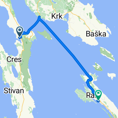
Insel Cres: von Cres nach Osor
A cycling route starting in Cres, Primorsko-Goranska Županija, Croatia.
Overview
About this route
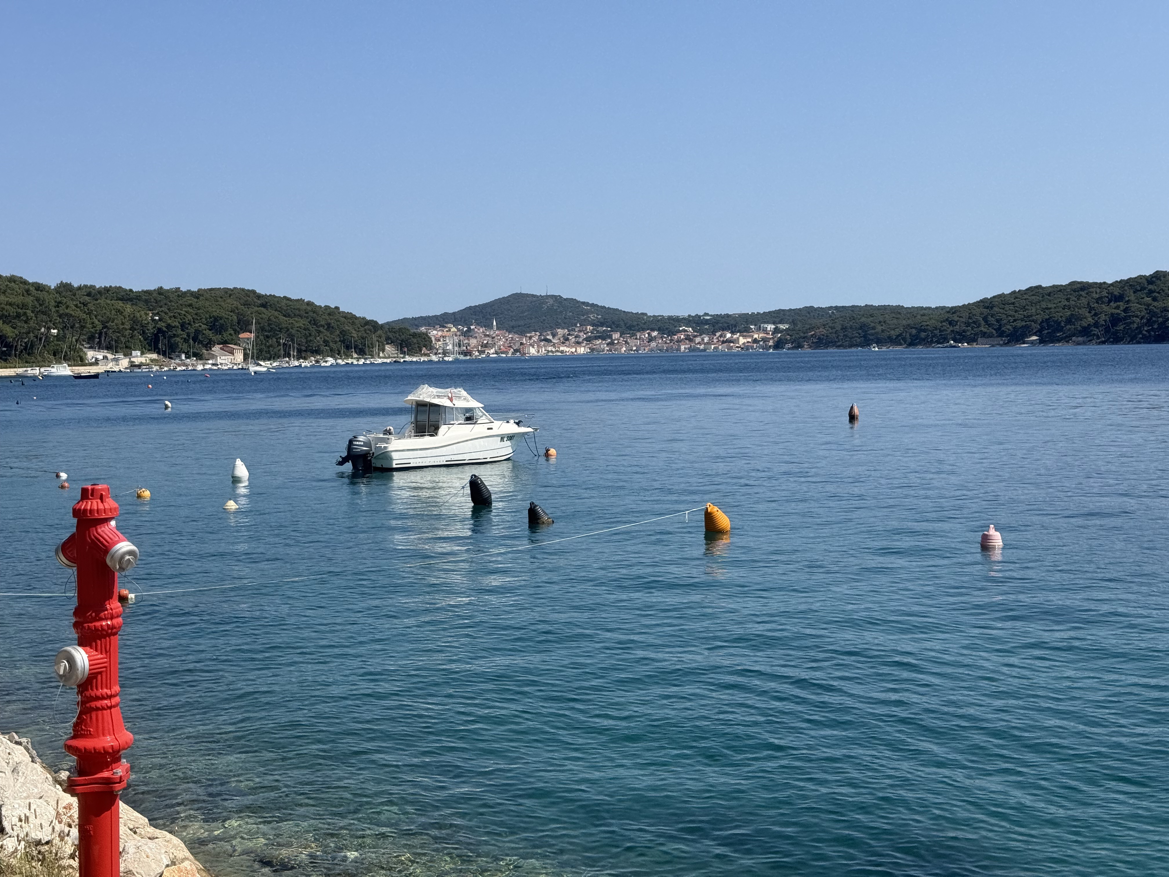
Vom Hafen der Segler-Stadt Cres geht es eine kleine Serpentine bis auf den Sattelpunkt hinauf und von dort aus über den Inselrücken am Vraner See vorbei. Zwischen alten Steinmauern bis in das Künstlerdorf Osor hinab, wo man gut Essen und wunderbar Baden kann.
Der Verkehr auf der Insel kommt schubweise, nämlich jedes Mal, wenn im Norden die Autofähre angelegt hat. Dazwischen ist die Strecke (außer im Hochsommer) jedoch ziemlich ruhig.
Diese Strecke ist Teil einer Pauschalreise mit Rad und Schiff, d.h. man wohnt auf einem Motorsegler, der einem täglich auf eine andere Insel bringt. Siehe www.inselhuepfen.de
- -:--
- Duration
- 33.3 km
- Distance
- 562 m
- Ascent
- 527 m
- Descent
- ---
- Avg. speed
- 348 m
- Avg. speed
Route quality
Waytypes & surfaces along the route
Waytypes
Busy road
27.1 km
(81 %)
Track
2.2 km
(7 %)
Surfaces
Paved
29.6 km
(89 %)
Unpaved
2.1 km
(6 %)
Asphalt
28.5 km
(86 %)
Concrete
1.1 km
(3 %)
Continue with Bikemap
Use, edit, or download this cycling route
You would like to ride Insel Cres: von Cres nach Osor or customize it for your own trip? Here is what you can do with this Bikemap route:
Free features
- Save this route as favorite or in collections
- Copy & plan your own version of this route
- Sync your route with Garmin or Wahoo
Premium features
Free trial for 3 days, or one-time payment. More about Bikemap Premium.
- Navigate this route on iOS & Android
- Export a GPX / KML file of this route
- Create your custom printout (try it for free)
- Download this route for offline navigation
Discover more Premium features.
Get Bikemap PremiumFrom our community
Other popular routes starting in Cres
- cres do sv.blaza
- Distance
- 14.6 km
- Ascent
- 186 m
- Descent
- 302 m
- Location
- Cres, Primorsko-Goranska Županija, Croatia
- Martinšćica to Cres town
- Distance
- 41.9 km
- Ascent
- 866 m
- Descent
- 875 m
- Location
- Cres, Primorsko-Goranska Županija, Croatia
- Urlaub 2009 Kroatien - Tag 5 - Insel Cres (Martinscica - Lubenice - Cres)
- Distance
- 39.5 km
- Ascent
- 1,008 m
- Descent
- 991 m
- Location
- Cres, Primorsko-Goranska Županija, Croatia
- 03 - ECT 2013 - CRES - RAB (28 km)
- Distance
- 63.7 km
- Ascent
- 476 m
- Descent
- 469 m
- Location
- Cres, Primorsko-Goranska Županija, Croatia
- Cres - Vransko - Cres
- Distance
- 50.2 km
- Ascent
- 881 m
- Descent
- 893 m
- Location
- Cres, Primorsko-Goranska Županija, Croatia
- Cres kerékpárral
- Distance
- 83.3 km
- Ascent
- 2,794 m
- Descent
- 2,799 m
- Location
- Cres, Primorsko-Goranska Županija, Croatia
- giro di Cres- Valun - Lubenice MTB
- Distance
- 51.6 km
- Ascent
- 895 m
- Descent
- 893 m
- Location
- Cres, Primorsko-Goranska Županija, Croatia
- Sveti Petar - Beli - Sveti Petar 1
- Distance
- 10 km
- Ascent
- 160 m
- Descent
- 192 m
- Location
- Cres, Primorsko-Goranska Županija, Croatia
Open it in the app