

1205 St.Martin - údoli Bluntautal
A cycling route starting in Eben im Pongau, Salzburg, Austria.
Overview
About this route
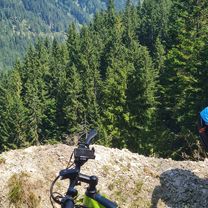
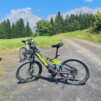
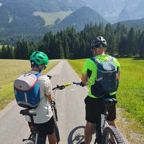
Almost always downhill, in the first part on the road, later around Lamer on a gravel cycle path, from the waterfall in Golling to the end through the forest. All sections can be ridden parallel on the road, so it's also suitable for road bikes.
- -:--
- Duration
- 42.5 km
- Distance
- 155 m
- Ascent
- 633 m
- Descent
- ---
- Avg. speed
- ---
- Max. altitude
Route quality
Waytypes & surfaces along the route
Waytypes
Quiet road
7.6 km
(18 %)
Road
6.8 km
(16 %)
Surfaces
Paved
34.8 km
(82 %)
Unpaved
3.8 km
(9 %)
Asphalt
34.8 km
(82 %)
Gravel
2.1 km
(5 %)
Continue with Bikemap
Use, edit, or download this cycling route
You would like to ride 1205 St.Martin - údoli Bluntautal or customize it for your own trip? Here is what you can do with this Bikemap route:
Free features
- Save this route as favorite or in collections
- Copy & plan your own version of this route
- Sync your route with Garmin or Wahoo
Premium features
Free trial for 3 days, or one-time payment. More about Bikemap Premium.
- Navigate this route on iOS & Android
- Export a GPX / KML file of this route
- Create your custom printout (try it for free)
- Download this route for offline navigation
Discover more Premium features.
Get Bikemap PremiumFrom our community
Other popular routes starting in Eben im Pongau
 Rund um den Gerzkopf
- Distance
- 45.3 km
- Ascent
- 1,120 m
- Descent
- 1,134 m
- Location
- Eben im Pongau, Salzburg, Austria
 Sattelbauerrunde
- Distance
- 30.2 km
- Ascent
- 1,008 m
- Descent
- 1,007 m
- Location
- Eben im Pongau, Salzburg, Austria
 Rossbrandrunde
- Distance
- 35 km
- Ascent
- 1,414 m
- Descent
- 1,414 m
- Location
- Eben im Pongau, Salzburg, Austria
 Aualm 1
- Distance
- 11 km
- Ascent
- 487 m
- Descent
- 268 m
- Location
- Eben im Pongau, Salzburg, Austria
 Teufelsgraben Rundfahrt
- Distance
- 50.9 km
- Ascent
- 1,318 m
- Descent
- 1,347 m
- Location
- Eben im Pongau, Salzburg, Austria
 Reitlehenalm von Eben aus
- Distance
- 14.4 km
- Ascent
- 722 m
- Descent
- 720 m
- Location
- Eben im Pongau, Salzburg, Austria
 Reitlehenalm
- Distance
- 18.6 km
- Ascent
- 662 m
- Descent
- 662 m
- Location
- Eben im Pongau, Salzburg, Austria
 Flachauwinkelrunde XL
- Distance
- 36.7 km
- Ascent
- 873 m
- Descent
- 861 m
- Location
- Eben im Pongau, Salzburg, Austria
Open it in the app