

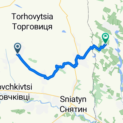
Вижниця
A cycling route starting in Zabolotiv, Ivano-Frankivsk Oblast, Ukraine.
Overview
About this route
- -:--
- Duration
- 42.3 km
- Distance
- 485 m
- Ascent
- 152 m
- Descent
- ---
- Avg. speed
- ---
- Max. altitude
Continue with Bikemap
Use, edit, or download this cycling route
You would like to ride Вижниця or customize it for your own trip? Here is what you can do with this Bikemap route:
Free features
- Save this route as favorite or in collections
- Copy & plan your own version of this route
- Sync your route with Garmin or Wahoo
Premium features
Free trial for 3 days, or one-time payment. More about Bikemap Premium.
- Navigate this route on iOS & Android
- Export a GPX / KML file of this route
- Create your custom printout (try it for free)
- Download this route for offline navigation
Discover more Premium features.
Get Bikemap PremiumFrom our community
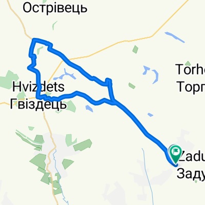
Other popular routes starting in Zabolotiv
 Vulytsya Bez Nazvy to Vulytsya Bez Nazvy
- Distance
- 26.1 km
- Ascent
- 304 m
- Descent
- 402 m
- Location
- Zabolotiv, Ivano-Frankivsk Oblast, Ukraine
 Vulytsya Bez Nazvy to Vulytsya Bez Nazvy
- Distance
- 32.8 km
- Ascent
- 304 m
- Descent
- 302 m
- Location
- Zabolotiv, Ivano-Frankivsk Oblast, Ukraine
 Kolomyya-Przemyśl
- Distance
- 433.7 km
- Ascent
- 894 m
- Descent
- 963 m
- Location
- Zabolotiv, Ivano-Frankivsk Oblast, Ukraine
 Вижниця
- Distance
- 42.3 km
- Ascent
- 485 m
- Descent
- 152 m
- Location
- Zabolotiv, Ivano-Frankivsk Oblast, Ukraine
 По дамбі р. Прут (Заболотів)
- Distance
- 5.6 km
- Ascent
- 4 m
- Descent
- 16 m
- Location
- Zabolotiv, Ivano-Frankivsk Oblast, Ukraine
Open it in the app