

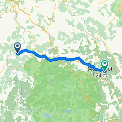
FR2
FR2-06_Coulanges-sur-Yonne_Appoigny_68,4km 150hm
A cycling route starting in Fontenailles, Bourgogne-Franche-Comté, France.
Overview
About this route
- 4 h 19 min
- Duration
- 70.1 km
- Distance
- 218 m
- Ascent
- 274 m
- Descent
- 16.3 km/h
- Avg. speed
- 157 m
- Max. altitude

Part of
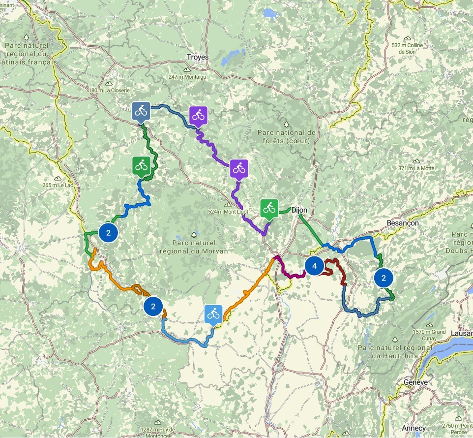
16 stages
Route quality
Waytypes & surfaces along the route
Waytypes
Cycleway
26.7 km
(38 %)
Path
21 km
(30 %)
Surfaces
Paved
52.6 km
(75 %)
Unpaved
0.7 km
(1 %)
Asphalt
49.8 km
(71 %)
Paved (undefined)
2.1 km
(3 %)
Route highlights
Points of interest along the route
Drinking water after 0.1 km
Bäckerei
Drinking water after 0.4 km
Supermarkt
Point of interest after 1.4 km
Rastplatz
Point of interest after 2 km
Église Saint-Étienne
Point of interest after 4.9 km
Rastplatz
Point of interest after 5 km
Rastplatz
Point of interest after 5.1 km
Rastplatz
Point of interest after 12 km
Château de Saint-Marc
Point of interest after 12.1 km
Rastbank
Point of interest after 12.1 km
Rastplatz
Point of interest after 12.1 km
Bank
Point of interest after 12.1 km
Toilette
Point of interest after 12.3 km
Rastplatz
Point of interest after 12.5 km
Bänke
Point of interest after 12.6 km
Rastplatz
Point of interest after 12.6 km
Bänke
Point of interest after 12.6 km
Bank
Point of interest after 16.4 km
Bank
Point of interest after 16.4 km
Les Rochers du Saussois
Point of interest after 16.8 km
Rastplatz unter den Höhlen von "Le Saussois"
Point of interest after 17.5 km
Rastplatz
Point of interest after 18.5 km
Bank
Point of interest after 18.7 km
Bänke
Point of interest after 19.4 km
Le Yonne et Rochers du Parc
Point of interest after 21.3 km
Mailly-le-Chateau
Point of interest after 25.3 km
Imbiss - 1 Eis?
Point of interest after 25.4 km
Toilette
Point of interest after 25.5 km
Rastplatz
Point of interest after 25.5 km
Plage de la Baignade de Mailly-la-Ville
Point of interest after 25.6 km
Links ab zum Badestrand
Point of interest after 25.9 km
Rastplatz
Drinking water after 26.1 km
Bäckerei
Point of interest after 26.3 km
Bank
Point of interest after 27.8 km
Rastplatz
Point of interest after 30.1 km
Bänke
Point of interest after 30.2 km
Rastplatz - am Bistro des Dames
Point of interest after 30.7 km
Bänke
Point of interest after 31 km
Bänke
Point of interest after 34 km
Rastplatz
Bike service after 35.3 km
Velos 89
Point of interest after 39.3 km
Bank
Point of interest after 39.7 km
Schleuse von Vincelles
Point of interest after 40.1 km
Château de Vincelles
Point of interest after 40.7 km
Bank
Bike service after 40.9 km
Cycle Divin
Point of interest after 43.3 km
Château du Saulce
Point of interest after 43.4 km
Pierre Merlier Museum
Point of interest after 44.2 km
Bank
Point of interest after 44.5 km
Château de Belombre
Point of interest after 45.2 km
Bank
Point of interest after 45.9 km
La Fontaine Sombron
Drinking water after 46.3 km
Atac mit Bäckerei
Point of interest after 49 km
Kirche Saint-Maurice d'Augy
Point of interest after 52.4 km
Viele Bänke
Photo after 53.1 km
Hier führt der Weg "La Coulée Verte" über die ehemalige Eisenbahnbrücke. Du kommst von dort auch auf die Vergnügungsinsel (L'Île aux Plaisirs). Außerdem hast Du einen schönen Blick auf die Kathedrale, den Fluss Yonne und die Schleuse Bartardeau am Kanal Nivermais.
Point of interest after 53.2 km
Toilette
Photo after 53.2 km
Pont pour l’île aux Plaisirs
Photo after 53.3 km
L'Île aux Plaisirs
Point of interest after 53.6 km
Toilette
Bike service after 53.6 km
Maison du Velo
Point of interest after 53.9 km
Bank
Point of interest after 54 km
Toilette
Point of interest after 54.1 km
Pont Paul Bert - Bei der Statue des Namensgebenden Paul Bert findest Du einen kleinen Balkon, von dem aus man den Paradeblick auf die Altstadt in Ruhe genießen kann.
Bike service after 54.1 km
Le Grand Braquet - Cycles Carvalho
Point of interest after 54.4 km
Bank
Point of interest after 54.4 km
Passarelle de la Liberte Thomas Jefferson
Point of interest after 54.5 km
Toilette
Photo after 55 km
Tour de l’Horloge
Point of interest after 55.1 km
Toilette
Photo after 55.4 km
Cathédrale Saint-Étienne - Beeindruckende Kathedrale, die das Stadtbild von Auxerre zusammen mit der Abbaye Saint-Germain dominiert. Man kann die Kathedrale kostenlos besichtigen, was man auch unbedingt machen sollte. Der Anblick von diesen unglaublich hohen gotischen Gewölben ist ein bleibendes Erlebnis. Die Krypta wurde von 1023 bis 1035 errichtet und stammt noch von der romanischen Kathedrale, die 1215 zerstört wurde. Die heutige Kathedrale wurde an der Stelle der alten romanischen Kathedrale errichtet. Die unterschiedlichen Bauabschnitte erstreckten sich vom 13. Jahrhundert bis zum 16. Jahrhundert.
Point of interest after 55.7 km
Toilette
Photo after 55.8 km
Abtei Saint-Germain d’Auxerre - herrlich auf einer anhöhe über dem fluss yonne gelegene ehemalige königliche abtei. sehr sehenswert sind der romanische turm, der gotische chor sowie die karolingische krypta. das um den malerischen kreuzgang angelegte museum hat allerhand zu bieten, objekte von der frühzeit bis zur moderne
Point of interest after 55.9 km
Toilette
Point of interest after 56.3 km
Bänke
Point of interest after 56.4 km
Bänke
Bike service after 56.6 km
Cycles Guenin Auxerre
Bike service after 57.3 km
Culture Vélo Auxerre
Point of interest after 57.6 km
Bänke
Point of interest after 57.7 km
Brassiere des Bords de l'Yonne
Point of interest after 59.1 km
Toilette
Point of interest after 59.1 km
Auchan
Point of interest after 59.1 km
Toilette
Point of interest after 62.3 km
Parc des Peupliers
Point of interest after 62.4 km
Bänke
Point of interest after 62.8 km
Bank
Point of interest after 63 km
Bank
Point of interest after 63 km
Viele Bänke, auch im Park
Point of interest after 63 km
Square de la Paix
Point of interest after 63 km
Moneteau parc les dumonts
Point of interest after 65 km
Rastplatz und Bänke
Point of interest after 66.2 km
Rastplatz
Point of interest after 66.4 km
La Cabane
Point of interest after 66.4 km
Rastplätze
Bike service after 66.6 km
L'atelier de Vincent
Accommodation after 70.1 km
Chambres & Tables d'Hôtes du Puits d'Athie
Continue with Bikemap
Use, edit, or download this cycling route
You would like to ride FR2-06_Coulanges-sur-Yonne_Appoigny_68,4km 150hm or customize it for your own trip? Here is what you can do with this Bikemap route:
Free features
- Save this route as favorite or in collections
- Copy & plan your own version of this route
- Sync your route with Garmin or Wahoo
Premium features
Free trial for 3 days, or one-time payment. More about Bikemap Premium.
- Navigate this route on iOS & Android
- Export a GPX / KML file of this route
- Create your custom printout (try it for free)
- Download this route for offline navigation
Discover more Premium features.
Get Bikemap PremiumFrom our community
Other popular routes starting in Fontenailles
 Les Barres, Sainpuits à Grande Rue, Saint-Amand-en-Puisaye
- Distance
- 21.7 km
- Ascent
- 261 m
- Descent
- 319 m
- Location
- Fontenailles, Bourgogne-Franche-Comté, France
 Coulanges-sur-Yonne to Châtel-Censoir
- Distance
- 11.4 km
- Ascent
- 186 m
- Descent
- 192 m
- Location
- Fontenailles, Bourgogne-Franche-Comté, France
 Route zu Guédelon
- Distance
- 17.3 km
- Ascent
- 222 m
- Descent
- 208 m
- Location
- Fontenailles, Bourgogne-Franche-Comté, France
 Fontenaille - Guedelon
- Distance
- 63 km
- Ascent
- 542 m
- Descent
- 542 m
- Location
- Fontenailles, Bourgogne-Franche-Comté, France
 FR2-06_Coulanges-sur-Yonne_Appoigny_68,4km 150hm
- Distance
- 70.1 km
- Ascent
- 218 m
- Descent
- 274 m
- Location
- Fontenailles, Bourgogne-Franche-Comté, France
 Les Barres, Sainpuits à Rue de la Puisaye, Bouhy
- Distance
- 11.3 km
- Ascent
- 144 m
- Descent
- 45 m
- Location
- Fontenailles, Bourgogne-Franche-Comté, France
 Route in Sainpuits
- Distance
- 54.9 km
- Ascent
- 492 m
- Descent
- 492 m
- Location
- Fontenailles, Bourgogne-Franche-Comté, France
 Fontenailles - Semur-en-Auxois
- Distance
- 72.4 km
- Ascent
- 214 m
- Descent
- 0 m
- Location
- Fontenailles, Bourgogne-Franche-Comté, France
Open it in the app