

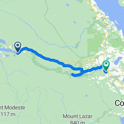
Cowichan Valley Trail
A cycling route starting in Lake Cowichan, British Columbia, Canada.
Overview
About this route
TransCanada Trail along abandoned rail line converted to bike/hiking trail. Not paved. Very scenic. Ample opportunities for camping and exploring. Best on a rugged touring bike or mountainbike.
- -:--
- Duration
- 68 km
- Distance
- 577 m
- Ascent
- 669 m
- Descent
- ---
- Avg. speed
- 213 m
- Max. altitude

Route quality
Waytypes & surfaces along the route
Waytypes
Path
36.7 km
(54 %)
Road
5.4 km
(8 %)
Surfaces
Paved
19 km
(28 %)
Unpaved
38.8 km
(57 %)
Gravel
37.4 km
(55 %)
Asphalt
13.6 km
(20 %)
Continue with Bikemap
Use, edit, or download this cycling route
You would like to ride Cowichan Valley Trail or customize it for your own trip? Here is what you can do with this Bikemap route:
Free features
- Save this route as favorite or in collections
- Copy & plan your own version of this route
- Sync your route with Garmin or Wahoo
Premium features
Free trial for 3 days, or one-time payment. More about Bikemap Premium.
- Navigate this route on iOS & Android
- Export a GPX / KML file of this route
- Create your custom printout (try it for free)
- Download this route for offline navigation
Discover more Premium features.
Get Bikemap PremiumFrom our community
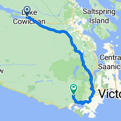
Other popular routes starting in Lake Cowichan
 Cowichan Valley Trail
- Distance
- 55.8 km
- Ascent
- 551 m
- Descent
- 553 m
- Location
- Lake Cowichan, British Columbia, Canada
 Riverside Pub
- Distance
- 24.3 km
- Ascent
- 173 m
- Descent
- 264 m
- Location
- Lake Cowichan, British Columbia, Canada
 Greendale Road 205, Lake Cowichan to Quamichan Avenue 164, Lake Cowichan
- Distance
- 19.8 km
- Ascent
- 631 m
- Descent
- 603 m
- Location
- Lake Cowichan, British Columbia, Canada
 Deer Rd, Lake Cowichan to Vivian Ave, Cowichan Valley
- Distance
- 44.9 km
- Ascent
- 619 m
- Descent
- 700 m
- Location
- Lake Cowichan, British Columbia, Canada
 Lake Cowichan to Cowichan Bay
- Distance
- 57.1 km
- Ascent
- 267 m
- Descent
- 425 m
- Location
- Lake Cowichan, British Columbia, Canada
 cowichan to sooke
- Distance
- 124.8 km
- Ascent
- 3,900 m
- Descent
- 4,049 m
- Location
- Lake Cowichan, British Columbia, Canada
 Lake Cowichan to Duncan
- Distance
- 39.4 km
- Ascent
- 226 m
- Descent
- 374 m
- Location
- Lake Cowichan, British Columbia, Canada
 Route to 3180–3184 Sooke River Rd, Sooke
- Distance
- 93.4 km
- Ascent
- 840 m
- Descent
- 1,040 m
- Location
- Lake Cowichan, British Columbia, Canada
Open it in the app