

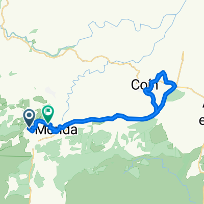
Circular S Alpujata salida Coín
A cycling route starting in Monda, Andalusia, Spain.
Overview
About this route
Ruta circular a la Sierra Alpujata saliendo desde Coín por la Albuqueria y regreso por Sierra Negra.
Puede hacerse una versión sólo tierra desde el cerro Castillejo hacia un depósito de agua (se evita la carretera que baja a Ojén desde la general de Marbella).
- -:--
- Duration
- 52.7 km
- Distance
- 1,117 m
- Ascent
- 1,106 m
- Descent
- ---
- Avg. speed
- ---
- Max. altitude
Route quality
Waytypes & surfaces along the route
Waytypes
Track
26.3 km
(50 %)
Path
18.4 km
(35 %)
Surfaces
Paved
16.9 km
(32 %)
Unpaved
5.8 km
(11 %)
Paved (undefined)
12.1 km
(23 %)
Ground
3.2 km
(6 %)
Continue with Bikemap
Use, edit, or download this cycling route
You would like to ride Circular S Alpujata salida Coín or customize it for your own trip? Here is what you can do with this Bikemap route:
Free features
- Save this route as favorite or in collections
- Copy & plan your own version of this route
- Sync your route with Garmin or Wahoo
Premium features
Free trial for 3 days, or one-time payment. More about Bikemap Premium.
- Navigate this route on iOS & Android
- Export a GPX / KML file of this route
- Create your custom printout (try it for free)
- Download this route for offline navigation
Discover more Premium features.
Get Bikemap PremiumFrom our community
Other popular routes starting in Monda
 gr243 modifcado
- Distance
- 51.2 km
- Ascent
- 1,239 m
- Descent
- 1,363 m
- Location
- Monda, Andalusia, Spain
 monda - pto golondrinas-
- Distance
- 44.2 km
- Ascent
- 845 m
- Descent
- 841 m
- Location
- Monda, Andalusia, Spain
 Castellar de la Frontera - San Pedro
- Distance
- 35.3 km
- Ascent
- 287 m
- Descent
- 596 m
- Location
- Monda, Andalusia, Spain
 Relaxed route in Mond
- Distance
- 31.6 km
- Ascent
- 563 m
- Descent
- 611 m
- Location
- Monda, Andalusia, Spain
 Monda til tosserne og Coin
- Distance
- 89.9 km
- Ascent
- 827 m
- Descent
- 1,000 m
- Location
- Monda, Andalusia, Spain
 Ruta: Monda-C. Migueletes-C. Corona-Monda
- Distance
- 56.4 km
- Ascent
- 1,142 m
- Descent
- 1,099 m
- Location
- Monda, Andalusia, Spain
 Sierra Istan-Tolox
- Distance
- 84.3 km
- Ascent
- 3,120 m
- Descent
- 3,115 m
- Location
- Monda, Andalusia, Spain
 Circular S Alpujata salida Coín
- Distance
- 52.7 km
- Ascent
- 1,117 m
- Descent
- 1,106 m
- Location
- Monda, Andalusia, Spain
Open it in the app