

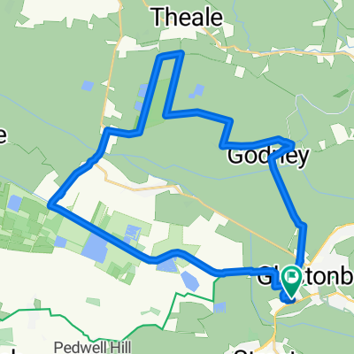
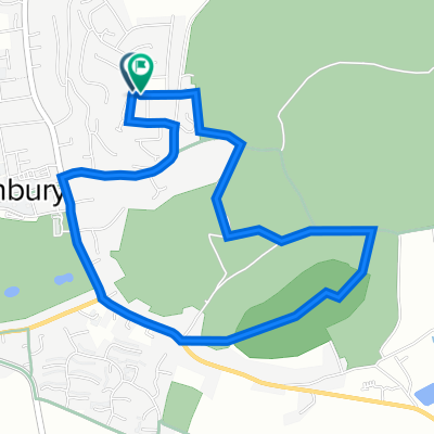
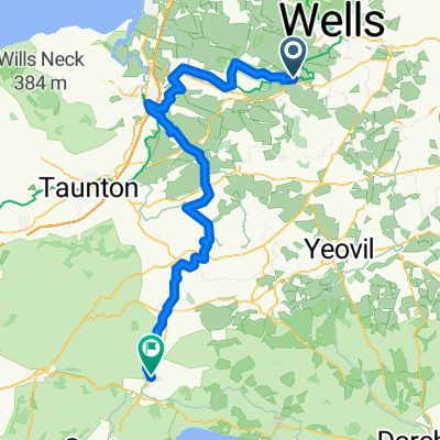
Glastonbury - Tetbury
A cycling route starting in Glastonbury, England, United Kingdom.
Overview
About this route
- 6 h 34 min
- Duration
- 99.3 km
- Distance
- 1,159 m
- Ascent
- 1,050 m
- Descent
- 15.1 km/h
- Avg. speed
- 240 m
- Max. altitude
Route quality
Waytypes & surfaces along the route
Waytypes
Quiet road
37.7 km
(38 %)
Cycleway
20.9 km
(21 %)
Surfaces
Paved
33.8 km
(34 %)
Unpaved
9.9 km
(10 %)
Asphalt
31.8 km
(32 %)
Gravel
6 km
(6 %)
Continue with Bikemap
Use, edit, or download this cycling route
You would like to ride Glastonbury - Tetbury or customize it for your own trip? Here is what you can do with this Bikemap route:
Free features
- Save this route as favorite or in collections
- Copy & plan your own version of this route
- Split it into stages to create a multi-day tour
- Sync your route with Garmin or Wahoo
Premium features
Free trial for 3 days, or one-time payment. More about Bikemap Premium.
- Navigate this route on iOS & Android
- Export a GPX / KML file of this route
- Create your custom printout (try it for free)
- Download this route for offline navigation
Discover more Premium features.
Get Bikemap PremiumFrom our community
Other popular routes starting in Glastonbury
 Glastonbury - Bath
- Distance
- 113.1 km
- Ascent
- 948 m
- Descent
- 869 m
- Location
- Glastonbury, England, United Kingdom
 Glastonbury - Tetbury
- Distance
- 99.3 km
- Ascent
- 1,159 m
- Descent
- 1,050 m
- Location
- Glastonbury, England, United Kingdom
 Wirral Park Road A39 to Wirral Park Road Unit 3
- Distance
- 27.5 km
- Ascent
- 18 m
- Descent
- 20 m
- Location
- Glastonbury, England, United Kingdom
 glastonbury to temple cloud
- Distance
- 40.8 km
- Ascent
- 448 m
- Descent
- 344 m
- Location
- Glastonbury, England, United Kingdom
 JOGLE AB day 14 77 miles
- Distance
- 124.4 km
- Ascent
- 731 m
- Descent
- 670 m
- Location
- Glastonbury, England, United Kingdom
 Glastonbury Tor Route
- Distance
- 3.9 km
- Ascent
- 114 m
- Descent
- 111 m
- Location
- Glastonbury, England, United Kingdom
 JOGLE 26-07-11 Day 10v2
- Distance
- 148.4 km
- Ascent
- 987 m
- Descent
- 841 m
- Location
- Glastonbury, England, United Kingdom
 Caerphilly - Chepstow
- Distance
- 84.9 km
- Ascent
- 528 m
- Descent
- 510 m
- Location
- Glastonbury, England, United Kingdom
Open it in the app