

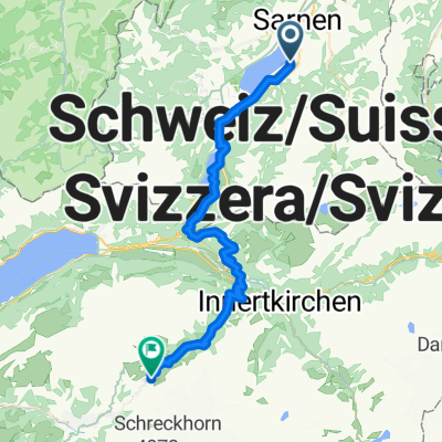
Sachseln - Glaubenberg - Entlebuch - Sörenberg - Glaubenbielen - Sachseln
A cycling route starting in Sachseln, Canton of Obwalden, Switzerland.
Overview
About this route
- -:--
- Duration
- 85.9 km
- Distance
- 2,035 m
- Ascent
- 2,032 m
- Descent
- ---
- Avg. speed
- ---
- Max. altitude
Route quality
Waytypes & surfaces along the route
Waytypes
Road
43.2 km
(50 %)
Busy road
33.1 km
(39 %)
Surfaces
Paved
33.3 km
(39 %)
Unpaved
1.4 km
(2 %)
Asphalt
32.7 km
(38 %)
Gravel
1.4 km
(2 %)
Continue with Bikemap
Use, edit, or download this cycling route
You would like to ride Sachseln - Glaubenberg - Entlebuch - Sörenberg - Glaubenbielen - Sachseln or customize it for your own trip? Here is what you can do with this Bikemap route:
Free features
- Save this route as favorite or in collections
- Copy & plan your own version of this route
- Split it into stages to create a multi-day tour
- Sync your route with Garmin or Wahoo
Premium features
Free trial for 3 days, or one-time payment. More about Bikemap Premium.
- Navigate this route on iOS & Android
- Export a GPX / KML file of this route
- Create your custom printout (try it for free)
- Download this route for offline navigation
Discover more Premium features.
Get Bikemap PremiumFrom our community
Other popular routes starting in Sachseln
 07 Sachseln - Hochdorf
- Distance
- 48.8 km
- Ascent
- 352 m
- Descent
- 361 m
- Location
- Sachseln, Canton of Obwalden, Switzerland
 V2_E04_ALPX_Schweiz
- Distance
- 45.3 km
- Ascent
- 2,676 m
- Descent
- 1,206 m
- Location
- Sachseln, Canton of Obwalden, Switzerland
 Melchsee-Planplatten-Tour
- Distance
- 62 km
- Ascent
- 2,057 m
- Descent
- 2,058 m
- Location
- Sachseln, Canton of Obwalden, Switzerland
 CHALLENGE_07
- Distance
- 49.7 km
- Ascent
- 314 m
- Descent
- 290 m
- Location
- Sachseln, Canton of Obwalden, Switzerland
 los Glaunberg
- Distance
- 82.7 km
- Ascent
- 1,985 m
- Descent
- 1,986 m
- Location
- Sachseln, Canton of Obwalden, Switzerland
 Melchsee-Frutt
- Distance
- 62.7 km
- Ascent
- 1,921 m
- Descent
- 1,924 m
- Location
- Sachseln, Canton of Obwalden, Switzerland
 Seerunfahrt mit Steigung
- Distance
- 24.8 km
- Ascent
- 1,383 m
- Descent
- 1,397 m
- Location
- Sachseln, Canton of Obwalden, Switzerland
 2016_ch_e7
- Distance
- 48.5 km
- Ascent
- 390 m
- Descent
- 388 m
- Location
- Sachseln, Canton of Obwalden, Switzerland
Open it in the app