

Německo 2012-4.den-Main-Radweg
A cycling route starting in Lichtenfels, Bavaria, Germany.
Overview
About this route
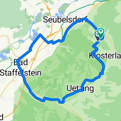
Day 4 of the route on 27.05.2012, the destination is the town of Bamberg and then further along the Main-Danube Canal.
Morning visit to the Basilica of the Fourteen Holy Helpers and attending the Sunday festive mass.
In Bamberg, sightseeing in the town center, then continuing on route No.11 Canal Route - RegnitzRadweg towards Nuremberg.
Overnight stay directly by the canal behind Altendorf.
Distance covered including Bamberg sightseeing: 68.5 km
Rest area Banzblick - Basilica of the Fourteen Holy Helpers - Grundfeld - Schönbrunn - Bad Staffelstein - Niederau - Ebensfeld - Unterleiterbach - Ebing - Rattelsdorf - Breitengüßbach - Kemmern - Bamberg - Main-Danube Canal - Strullendorf - Hirschaid - Altendorf - overnight on the first bench outside the town
- -:--
- Duration
- 68.4 km
- Distance
- 163 m
- Ascent
- 209 m
- Descent
- ---
- Avg. speed
- ---
- Max. altitude

Route highlights
Points of interest along the route

Photo after 0 km
3. nocleh - odpočívadlo

Photo after 1.1 km
Basilika Vierzehnheiligen

Photo after 43.3 km
Bamberg

Photo after 50.6 km
Main-Donau-Kanal

Photo after 53.4 km
Odpočivadlo

Photo after 58.1 km
Zdymadlo Strullendorf

Photo after 61.5 km
Hirschaid

Photo after 63.1 km
Skoro se nevešla

Photo after 68.2 km
Altendorf

Photo after 68.3 km
4.nocleh u Altendorfu
Continue with Bikemap
Use, edit, or download this cycling route
You would like to ride Německo 2012-4.den-Main-Radweg or customize it for your own trip? Here is what you can do with this Bikemap route:
Free features
- Save this route as favorite or in collections
- Copy & plan your own version of this route
- Sync your route with Garmin or Wahoo
Premium features
Free trial for 3 days, or one-time payment. More about Bikemap Premium.
- Navigate this route on iOS & Android
- Export a GPX / KML file of this route
- Create your custom printout (try it for free)
- Download this route for offline navigation
Discover more Premium features.
Get Bikemap PremiumFrom our community
Other popular routes starting in Lichtenfels
 Lichtenfels - 2 Klöster (Staffelberg, 14 Hlg. , Banz) nach Coburg
- Distance
- 45.8 km
- Ascent
- 630 m
- Descent
- 602 m
- Location
- Lichtenfels, Bavaria, Germany
 Kleiner Sonntagsausflug
- Distance
- 20.2 km
- Ascent
- 412 m
- Descent
- 408 m
- Location
- Lichtenfels, Bavaria, Germany
 Coburg-Runde
- Distance
- 68.3 km
- Ascent
- 638 m
- Descent
- 640 m
- Location
- Lichtenfels, Bavaria, Germany
 11.07.24 Coburg-Sand am Main (7. Etappe)
- Distance
- 87 km
- Ascent
- 329 m
- Descent
- 355 m
- Location
- Lichtenfels, Bavaria, Germany
 lichtenfels-bamberg
- Distance
- 38.3 km
- Ascent
- 62 m
- Descent
- 115 m
- Location
- Lichtenfels, Bavaria, Germany
 Jakobusweg LIF-BA-FO-N
- Distance
- 72.8 km
- Ascent
- 951 m
- Descent
- 960 m
- Location
- Lichtenfels, Bavaria, Germany
 Oberlangheim Stublang Reundorf
- Distance
- 25.7 km
- Ascent
- 286 m
- Descent
- 286 m
- Location
- Lichtenfels, Bavaria, Germany
 Německo 2012-4.den-Main-Radweg
- Distance
- 68.4 km
- Ascent
- 163 m
- Descent
- 209 m
- Location
- Lichtenfels, Bavaria, Germany
Open it in the app