

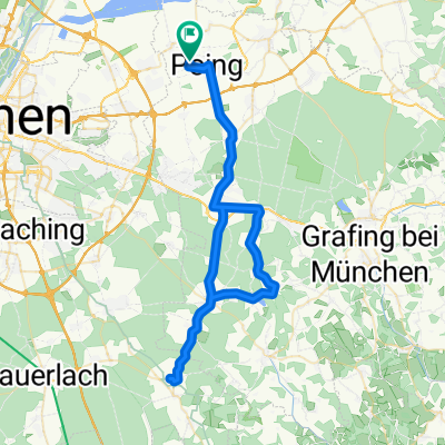
Poing - Forstern - Isen - MS - Poing
A cycling route starting in Poing, Bavaria, Germany.
Overview
About this route
- -:--
- Duration
- 54.8 km
- Distance
- 275 m
- Ascent
- 278 m
- Descent
- ---
- Avg. speed
- ---
- Max. altitude
Route quality
Waytypes & surfaces along the route
Waytypes
Quiet road
22.5 km
(41 %)
Road
15.4 km
(28 %)
Surfaces
Paved
53.7 km
(98 %)
Asphalt
53.2 km
(97 %)
Paved (undefined)
0.5 km
(1 %)
Undefined
1.1 km
(2 %)
Continue with Bikemap
Use, edit, or download this cycling route
You would like to ride Poing - Forstern - Isen - MS - Poing or customize it for your own trip? Here is what you can do with this Bikemap route:
Free features
- Save this route as favorite or in collections
- Copy & plan your own version of this route
- Sync your route with Garmin or Wahoo
Premium features
Free trial for 3 days, or one-time payment. More about Bikemap Premium.
- Navigate this route on iOS & Android
- Export a GPX / KML file of this route
- Create your custom printout (try it for free)
- Download this route for offline navigation
Discover more Premium features.
Get Bikemap PremiumFrom our community
Other popular routes starting in Poing
 Poing - Forstern - Isen - MS - Poing
- Distance
- 54.8 km
- Ascent
- 275 m
- Descent
- 278 m
- Location
- Poing, Bavaria, Germany
 Speichersee und BMW Teststrecke (
- Distance
- 37.6 km
- Ascent
- 43 m
- Descent
- 43 m
- Location
- Poing, Bavaria, Germany
 Rund um den Ebersberger Forst
- Distance
- 85.2 km
- Ascent
- 348 m
- Descent
- 346 m
- Location
- Poing, Bavaria, Germany
 Poing Ebersbergerforst Poing
- Distance
- 46.2 km
- Ascent
- 153 m
- Descent
- 152 m
- Location
- Poing, Bavaria, Germany
 Poing - Aying Biergarten - Poing Tour
- Distance
- 64.1 km
- Ascent
- 283 m
- Descent
- 280 m
- Location
- Poing, Bavaria, Germany
 Isar Mühle
- Distance
- 45.1 km
- Ascent
- 59 m
- Descent
- 59 m
- Location
- Poing, Bavaria, Germany
 Poing-Ebersberger Alm
- Distance
- 60 km
- Ascent
- 483 m
- Descent
- 483 m
- Location
- Poing, Bavaria, Germany
 frühlingstest
- Distance
- 18.9 km
- Ascent
- 62 m
- Descent
- 78 m
- Location
- Poing, Bavaria, Germany
Open it in the app