

*** Hügeltraining Wetterau (RB 059-0550)
A cycling route starting in Bad Vilbel, Hesse, Germany.
Overview
About this route
<p><strong>A nice hilly training route that mostly runs on paved bike and service roads. It is not a loop in the strict sense, as some sections are ridden multiple times. The climbs are neither particularly long (maximum 85 meters of elevation at once) nor particularly steep (rarely over 5% gradient). An average hobby road cyclist needs about 2 hours for the route.</strong></p>
<p></p>
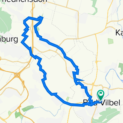
<p>The route starts in the Frankfurt district of Bergen-Enkheim at the 'Leuchte' bus stop on the street of the same name, near the Hessen-Center. Follow the road in a long left curve until it turns into Fritz-Schubert-Ring at the Riedbad. From now on it goes uphill with about a 5% gradient. Immediately after the church, turn right onto the lane at Königshof (Note: narrow one-way street that only cyclists may ride in this direction, so watch out for oncoming cars and it is best to turn right immediately and ride a few meters over cobblestones). Then turn right and continue on Marktstraße. Shortly before the village entrance, turn left and ride up Gräsigten Weg. Continue right onto Hohe Straße. Keep left and cross the main road. Hohe Straße is now a paved service road...</p>
<p></p>
<p><em>I designed this training route to be able to do interval-like 'hill training' on a relatively small area. Due to the many loops, it can be extended or shortened as needed.</em></p>
Translated, show original (German)- -:--
- Duration
- 58.6 km
- Distance
- 518 m
- Ascent
- 519 m
- Descent
- ---
- Avg. speed
- ---
- Max. altitude
Route quality
Waytypes & surfaces along the route
Waytypes
Track
42.2 km
(72 %)
Quiet road
5.3 km
(9 %)
Surfaces
Paved
58 km
(99 %)
Asphalt
58 km
(99 %)
Undefined
0.6 km
(1 %)
Route highlights
Points of interest along the route
Point of interest after 9.7 km
Achtung! Straßenüberquerung
Point of interest after 17.6 km
Achtung! Straßenüberquerung
Point of interest after 32.8 km
Achtung! Straßenüberquerung
Continue with Bikemap
Use, edit, or download this cycling route
You would like to ride *** Hügeltraining Wetterau (RB 059-0550) or customize it for your own trip? Here is what you can do with this Bikemap route:
Free features
- Save this route as favorite or in collections
- Copy & plan your own version of this route
- Sync your route with Garmin or Wahoo
Premium features
Free trial for 3 days, or one-time payment. More about Bikemap Premium.
- Navigate this route on iOS & Android
- Export a GPX / KML file of this route
- Create your custom printout (try it for free)
- Download this route for offline navigation
Discover more Premium features.
Get Bikemap PremiumFrom our community
Other popular routes starting in Bad Vilbel
 Rundroute Bad Vilbel - Bad Homburg
- Distance
- 37.3 km
- Ascent
- 268 m
- Descent
- 269 m
- Location
- Bad Vilbel, Hesse, Germany
 Büdinger-Runde M (RB 091-0450)
- Distance
- 93.1 km
- Ascent
- 314 m
- Descent
- 313 m
- Location
- Bad Vilbel, Hesse, Germany
 RR Schnelle Feierabendrunde Frankfurt/Wetterau
- Distance
- 44 km
- Ascent
- 292 m
- Descent
- 276 m
- Location
- Bad Vilbel, Hesse, Germany
 Rundkurs ab Enkheim
- Distance
- 47.8 km
- Ascent
- 278 m
- Descent
- 285 m
- Location
- Bad Vilbel, Hesse, Germany
 Grüngürtel
- Distance
- 64.6 km
- Ascent
- 219 m
- Descent
- 212 m
- Location
- Bad Vilbel, Hesse, Germany
 Bad Vilbel - Bonames - Weißkirchen - Ober Eschbach - Ober-Erlenbach - Nieder-Erlenbach - Bad Vilbel
- Distance
- 31.2 km
- Ascent
- 130 m
- Descent
- 124 m
- Location
- Bad Vilbel, Hesse, Germany
 Ronneburgrunde südlich (RB 073 - 0340)
- Distance
- 73.2 km
- Ascent
- 321 m
- Descent
- 321 m
- Location
- Bad Vilbel, Hesse, Germany
 Eschbach-Erlenbach
- Distance
- 26.8 km
- Ascent
- 92 m
- Descent
- 91 m
- Location
- Bad Vilbel, Hesse, Germany
Open it in the app