

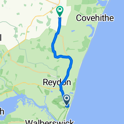
Leila ride
A cycling route starting in Southwold, England, United Kingdom.
Overview
About this route
- -:--
- Duration
- 88.5 km
- Distance
- 225 m
- Ascent
- 225 m
- Descent
- ---
- Avg. speed
- ---
- Max. altitude

Route quality
Waytypes & surfaces along the route
Waytypes
Quiet road
64.6 km
(73 %)
Road
10.6 km
(12 %)
Surfaces
Paved
9.7 km
(11 %)
Unpaved
2.7 km
(3 %)
Asphalt
9.7 km
(11 %)
Gravel
0.9 km
(1 %)
Continue with Bikemap
Use, edit, or download this cycling route
You would like to ride Leila ride or customize it for your own trip? Here is what you can do with this Bikemap route:
Free features
- Save this route as favorite or in collections
- Copy & plan your own version of this route
- Split it into stages to create a multi-day tour
- Sync your route with Garmin or Wahoo
Premium features
Free trial for 3 days, or one-time payment. More about Bikemap Premium.
- Navigate this route on iOS & Android
- Export a GPX / KML file of this route
- Create your custom printout (try it for free)
- Download this route for offline navigation
Discover more Premium features.
Get Bikemap PremiumFrom our community
Other popular routes starting in Southwold
 Southwold - Walberswick
- Distance
- 4.1 km
- Ascent
- 9 m
- Descent
- 19 m
- Location
- Southwold, England, United Kingdom
 Southwold Crit
- Distance
- 7.3 km
- Ascent
- 23 m
- Descent
- 26 m
- Location
- Southwold, England, United Kingdom
 Lost Lanes - 26: Sun, Sea & Suffolk
- Distance
- 78.5 km
- Ascent
- 372 m
- Descent
- 372 m
- Location
- Southwold, England, United Kingdom
 Dunwich to Theberton
- Distance
- 8.7 km
- Ascent
- 45 m
- Descent
- 44 m
- Location
- Southwold, England, United Kingdom
 Park Lane 20 to Southwold Road 96, Wrentham
- Distance
- 7.4 km
- Ascent
- 39 m
- Descent
- 42 m
- Location
- Southwold, England, United Kingdom
 8 Windsor Road, Southwold to 5 Windsor Road, Southwold
- Distance
- 18 km
- Ascent
- 0 m
- Descent
- 9 m
- Location
- Southwold, England, United Kingdom
 26SS Lost Lanes Sun, Sea and Suffolk
- Distance
- 71.1 km
- Ascent
- 308 m
- Descent
- 306 m
- Location
- Southwold, England, United Kingdom
 Walbesworld 2018
- Distance
- 8.2 km
- Ascent
- 18 m
- Descent
- 16 m
- Location
- Southwold, England, United Kingdom
Open it in the app