
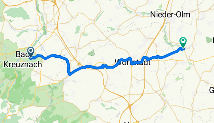
Bosenheimer Straße 202, Bad Kreuznach nach Zur Wäschbach 16, Hahnheim
A cycling route starting in Bad Kreuznach, Rhineland-Palatinate, Germany.
Overview
About this route
- 2 h 19 min
- Duration
- 34.1 km
- Distance
- 287 m
- Ascent
- 264 m
- Descent
- 14.7 km/h
- Avg. speed
- 254 m
- Max. altitude
Route quality
Waytypes & surfaces along the route
Waytypes
Track
18.7 km
(55 %)
Quiet road
5.8 km
(17 %)
Surfaces
Paved
29.6 km
(87 %)
Unpaved
0.7 km
(2 %)
Asphalt
17 km
(50 %)
Paved (undefined)
9.2 km
(27 %)
Continue with Bikemap
Use, edit, or download this cycling route
You would like to ride Bosenheimer Straße 202, Bad Kreuznach nach Zur Wäschbach 16, Hahnheim or customize it for your own trip? Here is what you can do with this Bikemap route:
Free features
- Save this route as favorite or in collections
- Copy & plan your own version of this route
- Sync your route with Garmin or Wahoo
Premium features
Free trial for 3 days, or one-time payment. More about Bikemap Premium.
- Navigate this route on iOS & Android
- Export a GPX / KML file of this route
- Create your custom printout (try it for free)
- Download this route for offline navigation
Discover more Premium features.
Get Bikemap PremiumFrom our community
Other popular routes starting in Bad Kreuznach
 BK - WE - BK
- Distance
- 24 km
- Ascent
- 172 m
- Descent
- 169 m
- Location
- Bad Kreuznach, Rhineland-Palatinate, Germany
 Bad Kreuznach Trail Rides
- Distance
- 28.9 km
- Ascent
- 649 m
- Descent
- 646 m
- Location
- Bad Kreuznach, Rhineland-Palatinate, Germany
 April Sonnen Trailfeuerwerk CLONED FROM ROUTE 444917
- Distance
- 31.2 km
- Ascent
- 667 m
- Descent
- 670 m
- Location
- Bad Kreuznach, Rhineland-Palatinate, Germany
 Hergenfeldrunde
- Distance
- 33.5 km
- Ascent
- 477 m
- Descent
- 443 m
- Location
- Bad Kreuznach, Rhineland-Palatinate, Germany
 Flacher Rundkurs Kreuznach-Bingen-Ingelheim-Kreuznach
- Distance
- 57.2 km
- Ascent
- 127 m
- Descent
- 127 m
- Location
- Bad Kreuznach, Rhineland-Palatinate, Germany
 Panoramatour Bad Kreuznach
- Distance
- 28.4 km
- Ascent
- 731 m
- Descent
- 730 m
- Location
- Bad Kreuznach, Rhineland-Palatinate, Germany
 RLP13a: Bad Kreuznach - Monsheim 67,1km 394hm
- Distance
- 67.1 km
- Ascent
- 394 m
- Descent
- 363 m
- Location
- Bad Kreuznach, Rhineland-Palatinate, Germany
 Panoramatour Bad Kreuznach
- Distance
- 28.4 km
- Ascent
- 592 m
- Descent
- 590 m
- Location
- Bad Kreuznach, Rhineland-Palatinate, Germany
Open it in the app