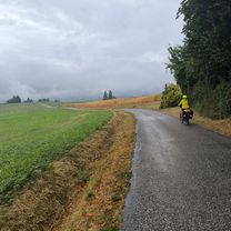
Allevard - Yenne
A cycling route starting in Yenne, Auvergne-Rh么ne-Alpes, France.
Overview
About this route
- -:--
- Duration
- 164.9 km
- Distance
- 4,045 m
- Ascent
- 3,772 m
- Descent
- ---
- Avg. speed
- ---
- Avg. speed
Route quality
Waytypes & surfaces along the route
Waytypes
Busy road
96.9 km
(59 %)
Road
60 km
(36 %)
Surfaces
Paved
144.4 km
(88 %)
Unpaved
0.9 km
(<1 %)
Asphalt
144.3 km
(88 %)
Gravel
0.9 km
(<1 %)
Route highlights
Points of interest along the route
Point of interest after 18.3 km
Mont du Chat
Point of interest after 62 km
Mont Revard
Point of interest after 96.9 km
Col des Pr茅s
Point of interest after 97.3 km
Col de Marocaz
Point of interest after 102.9 km
Mont Bisanne
Point of interest after 102.9 km
Col de Champ-Laurent
Point of interest after 102.9 km
Col des Cyclotouristes
Point of interest after 102.9 km
Collet de Tami茅
Point of interest after 102.9 km
Col du Grand Cucheron
Point of interest after 102.9 km
Col du Fr锚ne
Point of interest after 102.9 km
Col de la Forclaz
Point of interest after 102.9 km
Cormet de Roselend
Point of interest after 134 km
Col du Granier
Continue with Bikemap
Use, edit, or download this cycling route
You would like to ride Allevard - Yenne or customize it for your own trip? Here is what you can do with this Bikemap route:
Free features
- Save this route as favorite or in collections
- Copy & plan your own version of this route
- Sync your route with Garmin or Wahoo
Premium features
Free trial for 3 days, or one-time payment. More about Bikemap Premium.
- Navigate this route on iOS & Android
- Export a GPX / KML file of this route
- Create your custom printout (try it for free)
- Download this route for offline navigation
Discover more Premium features.
Get Bikemap PremiumFrom our community
Other popular routes starting in Yenne
- Jongieux 脿 St-Gerges (38)
- Distance
- 50.6 km
- Ascent
- 1,096 m
- Descent
- 516 m
- Location
- Yenne, Auvergne-Rh么ne-Alpes, France
- Chartreuse 21 - Etape 3 - Boucle Lacs du Bourget et d鈥橝iguebelette
- Distance
- 85.5 km
- Ascent
- 1,463 m
- Descent
- 1,463 m
- Location
- Yenne, Auvergne-Rh么ne-Alpes, France
- Allevard - Yenne
- Distance
- 164.9 km
- Ascent
- 4,045 m
- Descent
- 3,772 m
- Location
- Yenne, Auvergne-Rh么ne-Alpes, France
- Parcours Triathlon du chat S en cyclisme - 16 km
- Distance
- 17.1 km
- Ascent
- 336 m
- Descent
- 335 m
- Location
- Yenne, Auvergne-Rh么ne-Alpes, France
- Yenne - Culoz, circuit 55 km
- Distance
- 55.5 km
- Ascent
- 538 m
- Descent
- 540 m
- Location
- Yenne, Auvergne-Rh么ne-Alpes, France
- Yenne - P茅age de Roussillon
- Distance
- 109.6 km
- Ascent
- 545 m
- Descent
- 599 m
- Location
- Yenne, Auvergne-Rh么ne-Alpes, France
- sj to aix les bains
- Distance
- 17.2 km
- Ascent
- 669 m
- Descent
- 709 m
- Location
- Yenne, Auvergne-Rh么ne-Alpes, France
- Yenne - Dent du chat cot茅 Bourget
- Distance
- 50.6 km
- Ascent
- 1,716 m
- Descent
- 1,716 m
- Location
- Yenne, Auvergne-Rh么ne-Alpes, France
Open it in the app