

Star Cycles - Ansteys Hill
A cycling route starting in Elizabeth, South Australia, Australia.
Overview
About this route
Leaving Star Cycles, we ride down Bellchambers Rd on to West Av past the airbase and left on to Purling Av. Right on Commercial Rd and left to Bagsters Rd following this to Burton Rd where another left turn takes us down to Martins Rd where we turn right. Then left on to Kings Rd which we ride across the MN Rd and up McIntyre til we turn left at Montague Rd. Turning right on to Reservoir Rd, we Ppass TTP and on to Grand Junction Rd where we turn left and head towards Ansteys Hill. After the steady climb, we turn right at the summit of Ansteys and ride down the picturesque Range Rd South to Lower NE Rd where we turn left briefly before a right turn onto Range Rd North. A steady climb is followed by an fast descent, but bewarte the hairpin half way down, and the T- junction at Seaview Rd where we turn left and follow this down on to Yatala Vale Rd and Prices Bakery at Golden Grove Village. After our break, onwards down Grove Way, across the MN Rd on to Saints Rd, Fenden Rd and right onto Ponton St. Right on Commercial Rd, then right again on John Rice Av back to Elizabeth Way and Star Cycles.
- -:--
- Duration
- 58.8 km
- Distance
- 536 m
- Ascent
- 542 m
- Descent
- ---
- Avg. speed
- ---
- Max. altitude
Route quality
Waytypes & surfaces along the route
Waytypes
Road
17.6 km
(30 %)
Quiet road
9.4 km
(16 %)
Surfaces
Paved
55.9 km
(95 %)
Asphalt
43.5 km
(74 %)
Paved (undefined)
11.8 km
(20 %)
Continue with Bikemap
Use, edit, or download this cycling route
You would like to ride Star Cycles - Ansteys Hill or customize it for your own trip? Here is what you can do with this Bikemap route:
Free features
- Save this route as favorite or in collections
- Copy & plan your own version of this route
- Sync your route with Garmin or Wahoo
Premium features
Free trial for 3 days, or one-time payment. More about Bikemap Premium.
- Navigate this route on iOS & Android
- Export a GPX / KML file of this route
- Create your custom printout (try it for free)
- Download this route for offline navigation
Discover more Premium features.
Get Bikemap PremiumFrom our community
Other popular routes starting in Elizabeth
 1/1 ride
- Distance
- 47.6 km
- Ascent
- 1,467 m
- Descent
- 1,465 m
- Location
- Elizabeth, South Australia, Australia
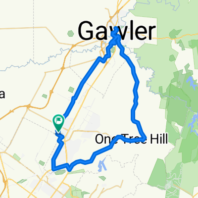 One Tree Hill Scenic route Gawler
- Distance
- 57.1 km
- Ascent
- 330 m
- Descent
- 330 m
- Location
- Elizabeth, South Australia, Australia
 trip...
- Distance
- 11.6 km
- Ascent
- 25 m
- Descent
- 56 m
- Location
- Elizabeth, South Australia, Australia
 Star Cycles Inglewood-COP-Kersbrook
- Distance
- 64 km
- Ascent
- 717 m
- Descent
- 717 m
- Location
- Elizabeth, South Australia, Australia
 Angaston to Handorf
- Distance
- 234.1 km
- Ascent
- 1,334 m
- Descent
- 1,333 m
- Location
- Elizabeth, South Australia, Australia
 Star Cycles - Sandy Creek - hillier rd
- Distance
- 59.8 km
- Ascent
- 196 m
- Descent
- 196 m
- Location
- Elizabeth, South Australia, Australia
 Yorktown Road 32, Elizabeth East to McCormack Crescent 50, Salisbury North
- Distance
- 20.9 km
- Ascent
- 255 m
- Descent
- 285 m
- Location
- Elizabeth, South Australia, Australia
 Little Para River Trl, Salisbury Park to 12 Main St, Mawson Lakes
- Distance
- 12.3 km
- Ascent
- 30 m
- Descent
- 70 m
- Location
- Elizabeth, South Australia, Australia
Open it in the app