

ZH- Sklené Teplice- Repište- Zlatý vrch
A cycling route starting in Žiar nad Hronom, Banská Bystrica Region, Slovakia.
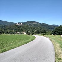
Overview
About this route
Asfalt - cesty, polne / lesne cesty
- 1 h 51 min
- Duration
- 20 km
- Distance
- 1,032 m
- Ascent
- 470 m
- Descent
- 10.9 km/h
- Avg. speed
- 836 m
- Max. altitude

Route quality
Waytypes & surfaces along the route
Waytypes
Road
9.8 km
(49 %)
Track
7.8 km
(39 %)
Surfaces
Paved
4.2 km
(21 %)
Unpaved
5.3 km
(27 %)
Asphalt
2.6 km
(13 %)
Ground
2.2 km
(11 %)
Continue with Bikemap
Use, edit, or download this cycling route
You would like to ride ZH- Sklené Teplice- Repište- Zlatý vrch or customize it for your own trip? Here is what you can do with this Bikemap route:
Free features
- Save this route as favorite or in collections
- Copy & plan your own version of this route
- Sync your route with Garmin or Wahoo
Premium features
Free trial for 3 days, or one-time payment. More about Bikemap Premium.
- Navigate this route on iOS & Android
- Export a GPX / KML file of this route
- Create your custom printout (try it for free)
- Download this route for offline navigation
Discover more Premium features.
Get Bikemap PremiumFrom our community
Other popular routes starting in Žiar nad Hronom
 okruh lehota
- Distance
- 19.1 km
- Ascent
- 220 m
- Descent
- 233 m
- Location
- Žiar nad Hronom, Banská Bystrica Region, Slovakia
 Lutila-Repiste- Bartkov Majer - Vyhne-Bukovina-Lutila
- Distance
- 62.9 km
- Ascent
- 771 m
- Descent
- 771 m
- Location
- Žiar nad Hronom, Banská Bystrica Region, Slovakia
 ŽH- Dolná / Horná Ves - Kremnica
- Distance
- 16.7 km
- Ascent
- 310 m
- Descent
- 35 m
- Location
- Žiar nad Hronom, Banská Bystrica Region, Slovakia
 slobodné jazero
- Distance
- 24.4 km
- Ascent
- 545 m
- Descent
- 517 m
- Location
- Žiar nad Hronom, Banská Bystrica Region, Slovakia
 Slovenského národného povstania 2, Žiar nad Hronom do J. Hollého 5
- Distance
- 48.7 km
- Ascent
- 1,050 m
- Descent
- 1,007 m
- Location
- Žiar nad Hronom, Banská Bystrica Region, Slovakia
 Vtačnik, Biela skala,
- Distance
- 64 km
- Ascent
- 1,562 m
- Descent
- 1,551 m
- Location
- Žiar nad Hronom, Banská Bystrica Region, Slovakia
 Stara Kremnicka - tlacenie -Pitelova - Jastraba - Nevolne - Kremnica
- Distance
- 25.1 km
- Ascent
- 796 m
- Descent
- 529 m
- Location
- Žiar nad Hronom, Banská Bystrica Region, Slovakia
 PWG ~pohovor👍🚴👍31.7.²0²0
- Distance
- 47.8 km
- Ascent
- 299 m
- Descent
- 293 m
- Location
- Žiar nad Hronom, Banská Bystrica Region, Slovakia
Open it in the app