

2025 3 Talange Trier
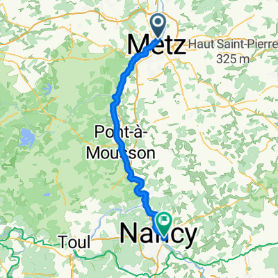
A cycling route starting in Saint-Julien-lès-Metz, Grand Est, France.
Overview
About this route
- 6 h 50 min
- Duration
- 112.9 km
- Distance
- 506 m
- Ascent
- 529 m
- Descent
- 16.5 km/h
- Avg. speed
- 184 m
- Max. altitude
Route quality
Waytypes & surfaces along the route
Waytypes
Path
62.1 km
(55 %)
Access road
22.6 km
(20 %)
Surfaces
Paved
99.3 km
(88 %)
Asphalt
82.4 km
(73 %)
Paved (undefined)
13.5 km
(12 %)
Continue with Bikemap
Use, edit, or download this cycling route
You would like to ride 2025 3 Talange Trier or customize it for your own trip? Here is what you can do with this Bikemap route:
Free features
- Save this route as favorite or in collections
- Copy & plan your own version of this route
- Split it into stages to create a multi-day tour
- Sync your route with Garmin or Wahoo
Premium features
Free trial for 3 days, or one-time payment. More about Bikemap Premium.
- Navigate this route on iOS & Android
- Export a GPX / KML file of this route
- Create your custom printout (try it for free)
- Download this route for offline navigation
Discover more Premium features.
Get Bikemap PremiumFrom our community
Other popular routes starting in Saint-Julien-lès-Metz
 5 A/ Metz - do Campingu.
- Distance
- 4 km
- Ascent
- 21 m
- Descent
- 17 m
- Location
- Saint-Julien-lès-Metz, Grand Est, France
 5 A/ Metz do campingu przy Rue du Pont des Mort.
- Distance
- 2.9 km
- Ascent
- 17 m
- Descent
- 14 m
- Location
- Saint-Julien-lès-Metz, Grand Est, France
 Moselradweg bis Konztanz
- Distance
- 257.6 km
- Ascent
- 352 m
- Descent
- 443 m
- Location
- Saint-Julien-lès-Metz, Grand Est, France
 Metz-Bitche-Obersteinbach
- Distance
- 127.5 km
- Ascent
- 768 m
- Descent
- 753 m
- Location
- Saint-Julien-lès-Metz, Grand Est, France
 2025 3 Talange Trier
- Distance
- 112.9 km
- Ascent
- 506 m
- Descent
- 529 m
- Location
- Saint-Julien-lès-Metz, Grand Est, France
 pourquoi ?
- Distance
- 19.1 km
- Ascent
- 150 m
- Descent
- 169 m
- Location
- Saint-Julien-lès-Metz, Grand Est, France
 les pommes
- Distance
- 27.3 km
- Ascent
- 163 m
- Descent
- 160 m
- Location
- Saint-Julien-lès-Metz, Grand Est, France
 Metz - Nancy
- Distance
- 71.8 km
- Ascent
- 71 m
- Descent
- 42 m
- Location
- Saint-Julien-lès-Metz, Grand Est, France
Open it in the app