

Aubenas - Les Estables
A cycling route starting in Laussonne, Auvergne-Rhône-Alpes, France.
Overview
About this route
- -:--
- Duration
- 220.8 km
- Distance
- 3,180 m
- Ascent
- 4,292 m
- Descent
- ---
- Avg. speed
- ---
- Max. altitude

Route quality
Waytypes & surfaces along the route
Waytypes
Road
57.4 km
(26 %)
Track
37.5 km
(17 %)
Surfaces
Paved
119.2 km
(54 %)
Unpaved
37.5 km
(17 %)
Asphalt
119.2 km
(54 %)
Ground
37.5 km
(17 %)
Undefined
64 km
(29 %)
Route highlights
Points of interest along the route
Point of interest after 0 km
Col de la Loge
Point of interest after 0 km
Col du Béal
Point of interest after 4 km
Col de la Croix de Boutières
Point of interest after 4.4 km
Col de la Croix de Boutières
Point of interest after 56.8 km
Mont Gerbier de Jonc
Point of interest after 56.8 km
Mont Gerbier de Jonc
Point of interest after 82.5 km
Col de la Charousse
Point of interest after 82.6 km
Col du Rouvey
Point of interest after 82.6 km
Col de l`Oeillon
Point of interest after 82.6 km
Col du Faux
Point of interest after 87.7 km
Col de la Mûre
Point of interest after 110.8 km
Larbonnet
Point of interest after 177.8 km
Col de la Chavade
Point of interest after 180.2 km
Col du Pendu
Point of interest after 180.2 km
Col du Pendu
Point of interest after 187.9 km
Col de Meyrand
Point of interest after 187.9 km
Point of interest after 188.1 km
Col de la Croix Bauzon
Continue with Bikemap
Use, edit, or download this cycling route
You would like to ride Aubenas - Les Estables or customize it for your own trip? Here is what you can do with this Bikemap route:
Free features
- Save this route as favorite or in collections
- Copy & plan your own version of this route
- Split it into stages to create a multi-day tour
- Sync your route with Garmin or Wahoo
Premium features
Free trial for 3 days, or one-time payment. More about Bikemap Premium.
- Navigate this route on iOS & Android
- Export a GPX / KML file of this route
- Create your custom printout (try it for free)
- Download this route for offline navigation
Discover more Premium features.
Get Bikemap PremiumFrom our community
Other popular routes starting in Laussonne
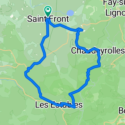
 Saint Front
- Distance
- 29.8 km
- Ascent
- 459 m
- Descent
- 457 m
- Location
- Laussonne, Auvergne-Rhône-Alpes, France
 Les estables
- Distance
- 62 km
- Ascent
- 642 m
- Descent
- 1,253 m
- Location
- Laussonne, Auvergne-Rhône-Alpes, France
 De D263 3, Saint-Front à Saint-Front
- Distance
- 8.1 km
- Ascent
- 197 m
- Descent
- 305 m
- Location
- Laussonne, Auvergne-Rhône-Alpes, France
 Aubenas - Les Estables
- Distance
- 248.8 km
- Ascent
- 3,307 m
- Descent
- 4,203 m
- Location
- Laussonne, Auvergne-Rhône-Alpes, France
 Transcevenole
- Distance
- 9.6 km
- Ascent
- 101 m
- Descent
- 203 m
- Location
- Laussonne, Auvergne-Rhône-Alpes, France
 Aubenas - Les Estables
- Distance
- 220.8 km
- Ascent
- 3,180 m
- Descent
- 4,292 m
- Location
- Laussonne, Auvergne-Rhône-Alpes, France
 Le lac St Front
- Distance
- 28.7 km
- Ascent
- 329 m
- Descent
- 789 m
- Location
- Laussonne, Auvergne-Rhône-Alpes, France
 les estables
- Distance
- 29.2 km
- Ascent
- 641 m
- Descent
- 641 m
- Location
- Laussonne, Auvergne-Rhône-Alpes, France
Open it in the app