Bourton on the Water - Chipping Norton
A cycling route starting in Westfield, England, United Kingdom.
Overview
About this route
- 5 h 19 min
- Duration
- 87.5 km
- Distance
- 990 m
- Ascent
- 998 m
- Descent
- 16.4 km/h
- Avg. speed
- 299 m
- Avg. speed
Route quality
Waytypes & surfaces along the route
Waytypes
Quiet road
55.4 km
(63 %)
Busy road
19.3 km
(22 %)
Surfaces
Paved
31.9 km
(36 %)
Unpaved
1.6 km
(2 %)
Asphalt
31.7 km
(36 %)
Ground
1.6 km
(2 %)
Continue with Bikemap
Use, edit, or download this cycling route
You would like to ride Bourton on the Water - Chipping Norton or customize it for your own trip? Here is what you can do with this Bikemap route:
Free features
- Save this route as favorite or in collections
- Copy & plan your own version of this route
- Sync your route with Garmin or Wahoo
Premium features
Free trial for 3 days, or one-time payment. More about Bikemap Premium.
- Navigate this route on iOS & Android
- Export a GPX / KML file of this route
- Create your custom printout (try it for free)
- Download this route for offline navigation
Discover more Premium features.
Get Bikemap PremiumFrom our community
Other popular routes starting in Westfield
- cotswolds
- Distance
- 26.6 km
- Ascent
- 294 m
- Descent
- 291 m
- Location
- Westfield, England, United Kingdom
- Bourton on the Water - Chipping Norton
- Distance
- 87.5 km
- Ascent
- 990 m
- Descent
- 998 m
- Location
- Westfield, England, United Kingdom
- Naunton loop cycle ride
- Distance
- 32.9 km
- Ascent
- 487 m
- Descent
- 473 m
- Location
- Westfield, England, United Kingdom
- Route 20a BOW W
- Distance
- 20.4 km
- Ascent
- 400 m
- Descent
- 329 m
- Location
- Westfield, England, United Kingdom
- Stow on the Wold - Woodstock
- Distance
- 95.8 km
- Ascent
- 1,130 m
- Descent
- 1,140 m
- Location
- Westfield, England, United Kingdom
- CotsHon2a
- Distance
- 27.5 km
- Ascent
- 327 m
- Descent
- 311 m
- Location
- Westfield, England, United Kingdom
- CotsHon2b
- Distance
- 58.4 km
- Ascent
- 544 m
- Descent
- 537 m
- Location
- Westfield, England, United Kingdom
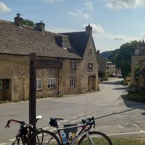
- Folly Farm to Chipping Campden
- Distance
- 56.2 km
- Ascent
- 538 m
- Descent
- 539 m
- Location
- Westfield, England, United Kingdom
Open it in the app