

Elsterradweg Hohenleipisch - Ruhland
A cycling route starting in Hohenleipisch, Brandenburg, Germany.
Overview
About this route
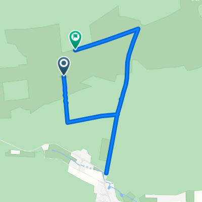
Radweg von Hohenleipisch nach Ruhland.
Zwischen Plessa und Abzweig Schraden ist es nur geschottert, aber trotzdem sehr gut befahrbar. Ab Abzweig Schraden sehr schöner asphaltierter Radweg bis Ruhland. Ist sehr zu empfehlen.
- -:--
- Duration
- 27.2 km
- Distance
- 45 m
- Ascent
- 86 m
- Descent
- ---
- Avg. speed
- ---
- Max. altitude
Route quality
Waytypes & surfaces along the route
Waytypes
Cycleway
8.3 km
(30 %)
Quiet road
5.4 km
(20 %)
Surfaces
Paved
20.5 km
(75 %)
Unpaved
3.2 km
(12 %)
Asphalt
20.5 km
(75 %)
Unpaved (undefined)
1.2 km
(5 %)
Continue with Bikemap
Use, edit, or download this cycling route
You would like to ride Elsterradweg Hohenleipisch - Ruhland or customize it for your own trip? Here is what you can do with this Bikemap route:
Free features
- Save this route as favorite or in collections
- Copy & plan your own version of this route
- Sync your route with Garmin or Wahoo
Premium features
Free trial for 3 days, or one-time payment. More about Bikemap Premium.
- Navigate this route on iOS & Android
- Export a GPX / KML file of this route
- Create your custom printout (try it for free)
- Download this route for offline navigation
Discover more Premium features.
Get Bikemap PremiumFrom our community
Other popular routes starting in Hohenleipisch
 Unnamed Road, Hohenleipisch nach Thiemigstraße 9, Elsterwerda
- Distance
- 31.9 km
- Ascent
- 132 m
- Descent
- 149 m
- Location
- Hohenleipisch, Brandenburg, Germany
 Elsterradweg Hohenleipisch - Ruhland
- Distance
- 27.2 km
- Ascent
- 45 m
- Descent
- 86 m
- Location
- Hohenleipisch, Brandenburg, Germany
 Gerade Fahrt in Hohenleipisch
- Distance
- 4 km
- Ascent
- 113 m
- Descent
- 114 m
- Location
- Hohenleipisch, Brandenburg, Germany
 Gorden, Gorden-Staupitz nach Seestraße 39, Potsdam
- Distance
- 127 km
- Ascent
- 469 m
- Descent
- 541 m
- Location
- Hohenleipisch, Brandenburg, Germany
 Unnamed Road, Hohenleipisch nach Uferstraße 2, Elsterwerda
- Distance
- 28.6 km
- Ascent
- 337 m
- Descent
- 352 m
- Location
- Hohenleipisch, Brandenburg, Germany
 Hohenleipisch - Berlin
- Distance
- 146.1 km
- Ascent
- 145 m
- Descent
- 241 m
- Location
- Hohenleipisch, Brandenburg, Germany
 Finsterwalde_Elsterwerda
- Distance
- 15.6 km
- Ascent
- 49 m
- Descent
- 60 m
- Location
- Hohenleipisch, Brandenburg, Germany
 Straße Ohne Straßennamen nach Straße Ohne Straßennamen
- Distance
- 4.4 km
- Ascent
- 11 m
- Descent
- 9 m
- Location
- Hohenleipisch, Brandenburg, Germany
Open it in the app