

Rajd Saksonii. Bastei-Rathen-Stolpen
A cycling route starting in Stadt Wehlen, Saxony, Germany.
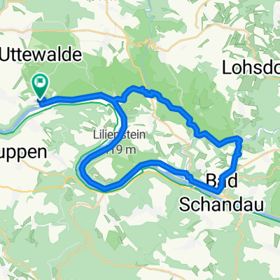
Overview
About this route
- -:--
- Duration
- 29.1 km
- Distance
- 583 m
- Ascent
- 470 m
- Descent
- ---
- Avg. speed
- ---
- Max. altitude

Continue with Bikemap
Use, edit, or download this cycling route
You would like to ride Rajd Saksonii. Bastei-Rathen-Stolpen or customize it for your own trip? Here is what you can do with this Bikemap route:
Free features
- Save this route as favorite or in collections
- Copy & plan your own version of this route
- Sync your route with Garmin or Wahoo
Premium features
Free trial for 3 days, or one-time payment. More about Bikemap Premium.
- Navigate this route on iOS & Android
- Export a GPX / KML file of this route
- Create your custom printout (try it for free)
- Download this route for offline navigation
Discover more Premium features.
Get Bikemap PremiumFrom our community
Other popular routes starting in Stadt Wehlen
 H2: Von der Bastei nach Stadt Wehlen
- Distance
- 5.2 km
- Ascent
- 50 m
- Descent
- 241 m
- Location
- Stadt Wehlen, Saxony, Germany
 Sächsiche Schweiz
- Distance
- 64.9 km
- Ascent
- 1,049 m
- Descent
- 1,006 m
- Location
- Stadt Wehlen, Saxony, Germany
 Wehlener Bergradrennen
- Distance
- 7.1 km
- Ascent
- 146 m
- Descent
- 144 m
- Location
- Stadt Wehlen, Saxony, Germany
 RockHead - Craft Your Gravel Story
- Distance
- 328.7 km
- Ascent
- 5,742 m
- Descent
- 5,710 m
- Location
- Stadt Wehlen, Saxony, Germany
 Basteirunde von Uttewalde
- Distance
- 13.1 km
- Ascent
- 337 m
- Descent
- 338 m
- Location
- Stadt Wehlen, Saxony, Germany
 Rundfahrt
- Distance
- 63.6 km
- Ascent
- 754 m
- Descent
- 761 m
- Location
- Stadt Wehlen, Saxony, Germany
 Polenztal über Rathen
- Distance
- 31.9 km
- Ascent
- 491 m
- Descent
- 474 m
- Location
- Stadt Wehlen, Saxony, Germany
 Festung Königsteiner Runde
- Distance
- 22.8 km
- Ascent
- 439 m
- Descent
- 439 m
- Location
- Stadt Wehlen, Saxony, Germany
Open it in the app