אשדוד-דמו 45
A cycling route starting in Ashdod, Southern District, Israel.
Overview
About this route
- 2 h 38 min
- Duration
- 45.4 km
- Distance
- 359 m
- Ascent
- 227 m
- Descent
- 17.3 km/h
- Avg. speed
- 166 m
- Avg. speed
Route quality
Waytypes & surfaces along the route
Waytypes
Track
23.3 km
(51 %)
Road
10.8 km
(24 %)
Surfaces
Paved
6.3 km
(14 %)
Unpaved
3.3 km
(7 %)
Asphalt
6.1 km
(14 %)
Ground
1.5 km
(3 %)
Continue with Bikemap
Use, edit, or download this cycling route
You would like to ride אשדוד-דמו 45 or customize it for your own trip? Here is what you can do with this Bikemap route:
Free features
- Save this route as favorite or in collections
- Copy & plan your own version of this route
- Sync your route with Garmin or Wahoo
Premium features
Free trial for 3 days, or one-time payment. More about Bikemap Premium.
- Navigate this route on iOS & Android
- Export a GPX / KML file of this route
- Create your custom printout (try it for free)
- Download this route for offline navigation
Discover more Premium features.
Get Bikemap PremiumFrom our community
Other popular routes starting in Ashdod
- Har Gilad Street 21, Ashdod to Har Metzada Street 27, Ashdod
- Distance
- 20.3 km
- Ascent
- 40 m
- Descent
- 39 m
- Location
- Ashdod, Southern District, Israel
- Spred Out Monday Track In Ashdod
- Distance
- 18.3 km
- Ascent
- 374 m
- Descent
- 371 m
- Location
- Ashdod, Southern District, Israel
- Har Gilad Street 16, Ashdod to 3631, Kfar Silver
- Distance
- 22 km
- Ascent
- 73 m
- Descent
- 87 m
- Location
- Ashdod, Southern District, Israel
- Har Gilad Street 14א, Ashdod to Hayam Hatichon Boulevard 1, Ashdod
- Distance
- 2.3 km
- Ascent
- 19 m
- Descent
- 17 m
- Location
- Ashdod, Southern District, Israel
- אשדוד-דמו 45
- Distance
- 45.4 km
- Ascent
- 359 m
- Descent
- 227 m
- Location
- Ashdod, Southern District, Israel
- אשדוד לצרעה
- Distance
- 43.7 km
- Ascent
- 270 m
- Descent
- 90 m
- Location
- Ashdod, Southern District, Israel
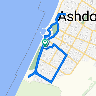
- אשדוד. טיילת, שטח חקלאי, פרק לחיש
- Distance
- 24.4 km
- Ascent
- 73 m
- Descent
- 71 m
- Location
- Ashdod, Southern District, Israel
- Oved ben Ami Boulevard, Ashdod to Har Gilad Street 12, Ashdod
- Distance
- 20.2 km
- Ascent
- 29 m
- Descent
- 45 m
- Location
- Ashdod, Southern District, Israel