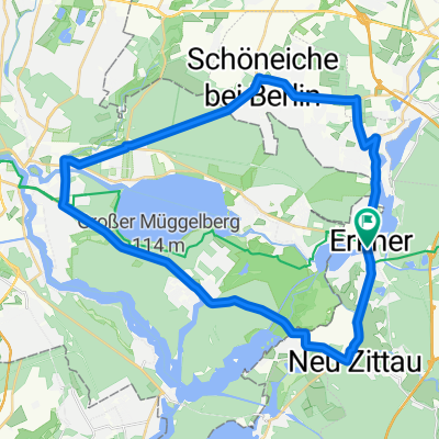
RTF Berliner Urstromtal 110 km
A cycling route starting in Erkner, Brandenburg, Germany.
Overview
About this route
RTF Veranstaltung
Veranstalter Erkneraner Radclub 1993 e.V.
70 km von Fürstenwalde über Rauen direkt nach Kolpin
40 km von Mönchwinkel über Kirchhofen nach Latzwall
- -:--
- Duration
- 103.6 km
- Distance
- 356 m
- Ascent
- 352 m
- Descent
- ---
- Avg. speed
- 87 m
- Avg. speed
Route quality
Waytypes & surfaces along the route
Waytypes
Busy road
33.4 km
(32 %)
Path
25.4 km
(25 %)
Surfaces
Paved
84.7 km
(82 %)
Unpaved
3 km
(3 %)
Asphalt
67.8 km
(65 %)
Paving stones
16.4 km
(16 %)
Continue with Bikemap
Use, edit, or download this cycling route
You would like to ride RTF Berliner Urstromtal 110 km or customize it for your own trip? Here is what you can do with this Bikemap route:
Free features
- Save this route as favorite or in collections
- Copy & plan your own version of this route
- Sync your route with Garmin or Wahoo
Premium features
Free trial for 3 days, or one-time payment. More about Bikemap Premium.
- Navigate this route on iOS & Android
- Export a GPX / KML file of this route
- Create your custom printout (try it for free)
- Download this route for offline navigation
Discover more Premium features.
Get Bikemap PremiumFrom our community
Other popular routes starting in Erkner
- Erkner nach Buckow (Märkische Schweiz), Umrundung des Schermützelsee und zurück nach Erkner
- Distance
- 80.1 km
- Ascent
- 407 m
- Descent
- 410 m
- Location
- Erkner, Brandenburg, Germany
- Am Flakensee über die WoDoSchleuse und Rahnsdorf
- Distance
- 19.5 km
- Ascent
- 79 m
- Descent
- 78 m
- Location
- Erkner, Brandenburg, Germany
- Alte Spree Erkner - Fürstenwalde
- Distance
- 68.6 km
- Ascent
- 79 m
- Descent
- 81 m
- Location
- Erkner, Brandenburg, Germany
- Erkner-Kirchhofe-Spreetal-Erkner
- Distance
- 39.7 km
- Ascent
- 128 m
- Descent
- 125 m
- Location
- Erkner, Brandenburg, Germany
- Erkner Fuerstenwalde Erkner
- Distance
- 69.9 km
- Ascent
- 105 m
- Descent
- 106 m
- Location
- Erkner, Brandenburg, Germany
- Müggelspreetour
- Distance
- 67.1 km
- Ascent
- 163 m
- Descent
- 160 m
- Location
- Erkner, Brandenburg, Germany
- perm Märkische Schweiz
- Distance
- 74.5 km
- Ascent
- 268 m
- Descent
- 262 m
- Location
- Erkner, Brandenburg, Germany
- mittlere trainingsrunde
- Distance
- 41.1 km
- Ascent
- 709 m
- Descent
- 706 m
- Location
- Erkner, Brandenburg, Germany
Open it in the app