

Holzkirchen Bahnhof - Bad Tölz - Holzkirchen Bahnhof
A cycling route starting in Holzkirchen, Bavaria, Germany.
Overview
About this route
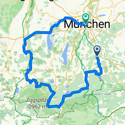
<p>Starting at Holzkirchen train station, we head along the road towards Bad Tölz. After a turn off the direct route to Tölz, we go into the forest after about 1 km. A beautiful route to Tölz, away from the road. Now and then we pass through small villages. Upon reaching Tölz, we head towards Holzkirchen, passing by Kirchsee. One can enjoy a wonderful view with the mountains behind the lake in complete peace. After Kirchsee, we return the last 10 km along the road.</p>
Translated, show original (German)- -:--
- Duration
- 53.5 km
- Distance
- 650 m
- Ascent
- 628 m
- Descent
- ---
- Avg. speed
- 762 m
- Max. altitude
Route quality
Waytypes & surfaces along the route
Waytypes
Quiet road
21.4 km
(40 %)
Track
16.1 km
(30 %)
Surfaces
Paved
37.5 km
(70 %)
Unpaved
15 km
(28 %)
Asphalt
36.4 km
(68 %)
Gravel
9.6 km
(18 %)
Continue with Bikemap
Use, edit, or download this cycling route
You would like to ride Holzkirchen Bahnhof - Bad Tölz - Holzkirchen Bahnhof or customize it for your own trip? Here is what you can do with this Bikemap route:
Free features
- Save this route as favorite or in collections
- Copy & plan your own version of this route
- Sync your route with Garmin or Wahoo
Premium features
Free trial for 3 days, or one-time payment. More about Bikemap Premium.
- Navigate this route on iOS & Android
- Export a GPX / KML file of this route
- Create your custom printout (try it for free)
- Download this route for offline navigation
Discover more Premium features.
Get Bikemap PremiumFrom our community
Other popular routes starting in Holzkirchen
 Feierabendrunde Hoki-Kirchsee-Bairawies-Hoki
- Distance
- 43.3 km
- Ascent
- 405 m
- Descent
- 394 m
- Location
- Holzkirchen, Bavaria, Germany
 Holzkirchen-Tegernsee
- Distance
- 18.8 km
- Ascent
- 189 m
- Descent
- 129 m
- Location
- Holzkirchen, Bavaria, Germany
 Holzkirchen-Bad Tölz
- Distance
- 57.5 km
- Ascent
- 764 m
- Descent
- 763 m
- Location
- Holzkirchen, Bavaria, Germany
 Holzkirchen Bahnhof - Bad Tölz - Holzkirchen Bahnhof
- Distance
- 53.5 km
- Ascent
- 650 m
- Descent
- 628 m
- Location
- Holzkirchen, Bavaria, Germany
 Kultur-Rad-Tour 2025
- Distance
- 298.5 km
- Ascent
- 3,017 m
- Descent
- 3,179 m
- Location
- Holzkirchen, Bavaria, Germany
 Hausstrecke
- Distance
- 46.4 km
- Ascent
- 311 m
- Descent
- 311 m
- Location
- Holzkirchen, Bavaria, Germany
 Gemütliche Alpenvorlandsstrecke
- Distance
- 39.6 km
- Ascent
- 357 m
- Descent
- 357 m
- Location
- Holzkirchen, Bavaria, Germany
 Holzkirchen nach Miesbach Krauthof Café über Höfe zurück
- Distance
- 46.5 km
- Ascent
- 781 m
- Descent
- 779 m
- Location
- Holzkirchen, Bavaria, Germany
Open it in the app