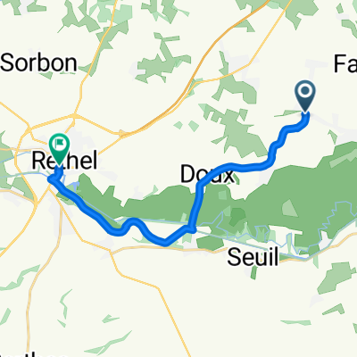
Rethel - Sens

A cycling route starting in Rethel, Grand Est, France.
OverviewAbout this route
-:--
Duration
210.2 km
Distance
905 m
Ascent
931 m
Descent
---
Avg. speed
---
Max. altitude
toto40created this 13 years ago
Route qualityWaytypes & surfaces along the route
Waytypes
  • Track

    42 km20 %
  • Quiet road

    29.4 km14 %
  • Road

    12.6 km6 %
Surfaces

Paved

111.4 km(53 %)

Unpaved

2.1 km(1 %)
  • Asphalt

    111.4 km53 %
  • Unpaved (undefined)

    2.1 km1 %
  • Undefined

    96.7 km46 %
Route highlightsPoints of interest along the route
  1. Point of interest after 210.2 km

    Col de la Givrine

  2. Point of interest after 210.2 km

    La Côte d'Aval

  3. Point of interest after 210.2 km

    Combe Gelée

  4. Point of interest after 210.2 km

    Roc Blanc

Continue with BikemapUse, edit, or download this cycling route
You would like to ride Rethel - Sens or customize it for your own trip? Here is what you can do with this Bikemap route:
Free features
Premium features

Free trial for 3 days, or one-time payment. More about Bikemap Premium.

  • Navigate this route on iOS & Android
  • Export a GPX / KML file of this route
  • Create your custom printout (try it for free)
  • Download this route for offline navigation

Discover more Premium features.

Get Bikemap Premium
From our communityOther popular routes starting in Rethel

Open it in the app