Gunpowder Falls medium loop
A cycling route starting in Hunt Valley, Maryland, United States.
Overview
About this route
hilly, not many shoulders
- -:--
- Duration
- 34.6 km
- Distance
- 356 m
- Ascent
- 356 m
- Descent
- ---
- Avg. speed
- ---
- Max. altitude
Continue with Bikemap
Use, edit, or download this cycling route
You would like to ride Gunpowder Falls medium loop or customize it for your own trip? Here is what you can do with this Bikemap route:
Free features
- Save this route as favorite or in collections
- Copy & plan your own version of this route
- Sync your route with Garmin or Wahoo
Premium features
Free trial for 3 days, or one-time payment. More about Bikemap Premium.
- Navigate this route on iOS & Android
- Export a GPX / KML file of this route
- Create your custom printout (try it for free)
- Download this route for offline navigation
Discover more Premium features.
Get Bikemap PremiumFrom our community
Other popular routes starting in Hunt Valley
- Sparks to Glen Rock Round Trip
- Distance
- 65 km
- Ascent
- 317 m
- Descent
- 316 m
- Location
- Hunt Valley, Maryland, United States
- Oregon Ridge to Prettyboy
- Distance
- 56.2 km
- Ascent
- 582 m
- Descent
- 582 m
- Location
- Hunt Valley, Maryland, United States
- Little Farm Loop
- Distance
- 41.1 km
- Ascent
- 461 m
- Descent
- 461 m
- Location
- Hunt Valley, Maryland, United States
- Torrey C Brown Rail Trail, Cockeysville to 21 Winterberry Ct, Cockeysville
- Distance
- 5.3 km
- Ascent
- 80 m
- Descent
- 77 m
- Location
- Hunt Valley, Maryland, United States
- Test home
- Distance
- 11.7 km
- Ascent
- 126 m
- Descent
- 83 m
- Location
- Hunt Valley, Maryland, United States
- Butler to My Lady's Manor
- Distance
- 49.3 km
- Ascent
- 430 m
- Descent
- 433 m
- Location
- Hunt Valley, Maryland, United States
- Gunpowder Falls medium loop
- Distance
- 34.6 km
- Ascent
- 356 m
- Descent
- 356 m
- Location
- Hunt Valley, Maryland, United States
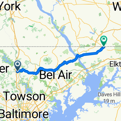
- 17716–17798 Masemore Rd, Parkton to 17701 Masemore Rd, Parkton
- Distance
- 20.2 km
- Ascent
- 471 m
- Descent
- 463 m
- Location
- Hunt Valley, Maryland, United States
Open it in the app