

Szekszárd-Szálka erdőn át
A cycling route starting in Szekszárd, Tolna County, Hungary.
Overview
About this route
The shortest traffic-free road route to Szálka. There is only one more challenging climb on the gravel road above Remete. The route starts from the Kéktúra trail, then you must follow the yellow, then the blue+ markers, and finally the blue marker again helps with navigation. Descending through the Szarvas Gorge is a real experience for terrain enthusiasts. I recommend it only in dry weather.
- -:--
- Duration
- 12.8 km
- Distance
- 225 m
- Ascent
- 128 m
- Descent
- ---
- Avg. speed
- ---
- Max. altitude

Route quality
Waytypes & surfaces along the route
Waytypes
Track
8.3 km
(65 %)
Quiet road
4.1 km
(32 %)
Path
0.4 km
(3 %)
Surfaces
Paved
2.8 km
(22 %)
Unpaved
4.5 km
(35 %)
Ground
4.5 km
(35 %)
Asphalt
2 km
(16 %)
Continue with Bikemap
Use, edit, or download this cycling route
You would like to ride Szekszárd-Szálka erdőn át or customize it for your own trip? Here is what you can do with this Bikemap route:
Free features
- Save this route as favorite or in collections
- Copy & plan your own version of this route
- Sync your route with Garmin or Wahoo
Premium features
Free trial for 3 days, or one-time payment. More about Bikemap Premium.
- Navigate this route on iOS & Android
- Export a GPX / KML file of this route
- Create your custom printout (try it for free)
- Download this route for offline navigation
Discover more Premium features.
Get Bikemap PremiumFrom our community
Other popular routes starting in Szekszárd
 Szekszárd sötétvölgy október
- Distance
- 15.2 km
- Ascent
- 361 m
- Descent
- 361 m
- Location
- Szekszárd, Tolna County, Hungary
 A két híd turája
- Distance
- 74.4 km
- Ascent
- 74 m
- Descent
- 73 m
- Location
- Szekszárd, Tolna County, Hungary
 Szekszárd-Szálka erdőn át
- Distance
- 12.8 km
- Ascent
- 225 m
- Descent
- 128 m
- Location
- Szekszárd, Tolna County, Hungary
 Szekszárd - Szedres - Zomba - Bonyhád - Alsónána - Szekszárd
- Distance
- 82.3 km
- Ascent
- 318 m
- Descent
- 317 m
- Location
- Szekszárd, Tolna County, Hungary
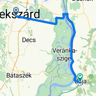 From Szekszárd to Baja
- Distance
- 41.3 km
- Ascent
- 85 m
- Descent
- 91 m
- Location
- Szekszárd, Tolna County, Hungary
 Gemenci-erdő körbetekerése, avagy a Két híd túrája
- Distance
- 80.9 km
- Ascent
- 91 m
- Descent
- 91 m
- Location
- Szekszárd, Tolna County, Hungary
 Bartina 15
- Distance
- 15.7 km
- Ascent
- 451 m
- Descent
- 429 m
- Location
- Szekszárd, Tolna County, Hungary
 Szekszárd-Sárpilis-Szálka-Szekszárd
- Distance
- 49.9 km
- Ascent
- 216 m
- Descent
- 216 m
- Location
- Szekszárd, Tolna County, Hungary
Open it in the app