

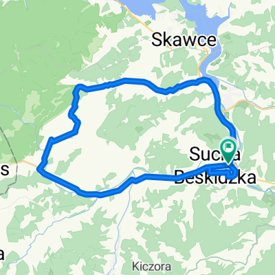
Route to Stryszawa 23C, 34-205 Stryszawa
A cycling route starting in Sucha Beskidzka, Lesser Poland Voivodeship, Poland.
Overview
About this route
- 14 h 38 min
- Duration
- 188.9 km
- Distance
- 4,420 m
- Ascent
- 4,363 m
- Descent
- 12.9 km/h
- Avg. speed
- 1,052 m
- Max. altitude

Route quality
Waytypes & surfaces along the route
Waytypes
Track
55.1 km
(29 %)
Quiet road
47 km
(25 %)
Surfaces
Paved
121.4 km
(64 %)
Unpaved
25.7 km
(14 %)
Asphalt
99.2 km
(53 %)
Paved (undefined)
17.4 km
(9 %)
Continue with Bikemap
Use, edit, or download this cycling route
You would like to ride Route to Stryszawa 23C, 34-205 Stryszawa or customize it for your own trip? Here is what you can do with this Bikemap route:
Free features
- Save this route as favorite or in collections
- Copy & plan your own version of this route
- Split it into stages to create a multi-day tour
- Sync your route with Garmin or Wahoo
Premium features
Free trial for 3 days, or one-time payment. More about Bikemap Premium.
- Navigate this route on iOS & Android
- Export a GPX / KML file of this route
- Create your custom printout (try it for free)
- Download this route for offline navigation
Discover more Premium features.
Get Bikemap PremiumFrom our community
Other popular routes starting in Sucha Beskidzka
 Memorialem Henryka Łasaka
- Distance
- 33.1 km
- Ascent
- 361 m
- Descent
- 350 m
- Location
- Sucha Beskidzka, Lesser Poland Voivodeship, Poland
 Z Suchej do Krakowa 19.06.2010
- Distance
- 61.1 km
- Ascent
- 272 m
- Descent
- 416 m
- Location
- Sucha Beskidzka, Lesser Poland Voivodeship, Poland
 Sucha Beskidzka - Wadowice (przez Leskowiec)
- Distance
- 32.6 km
- Ascent
- 682 m
- Descent
- 768 m
- Location
- Sucha Beskidzka, Lesser Poland Voivodeship, Poland
 30.08.2015
- Distance
- 129.6 km
- Ascent
- 1,073 m
- Descent
- 1,073 m
- Location
- Sucha Beskidzka, Lesser Poland Voivodeship, Poland
 trasa nr 1 na Jałowiec (1111 mnp)
- Distance
- 41.3 km
- Ascent
- 1,207 m
- Descent
- 1,203 m
- Location
- Sucha Beskidzka, Lesser Poland Voivodeship, Poland
 Route to Stryszawa 23C, 34-205 Stryszawa
- Distance
- 188.9 km
- Ascent
- 4,420 m
- Descent
- 4,363 m
- Location
- Sucha Beskidzka, Lesser Poland Voivodeship, Poland
 Europa Tour 2k14 11 Sucha Beskidzka - Rownica
- Distance
- 186.8 km
- Ascent
- 2,058 m
- Descent
- 1,539 m
- Location
- Sucha Beskidzka, Lesser Poland Voivodeship, Poland
 sucha Beskidzka
- Distance
- 20.9 km
- Ascent
- 561 m
- Descent
- 558 m
- Location
- Sucha Beskidzka, Lesser Poland Voivodeship, Poland
Open it in the app