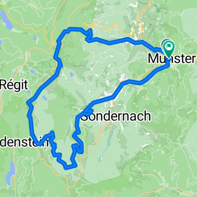
Munster_Tour3_MTB_3SeenTour
- 39.8 km
- 1,112 m
- 1,105 m
- Munster, Grand Est, France
A cycling route starting in Munster, Grand Est, France.
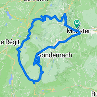
Overview
This tour of 94 km deliberately runs counterclockwise. Those who tackle the steep climb (sometimes 12%) to the Col de Platzerwasel (alt. 1186 m) first have the hardest work out of the way. On the Route des Crêtes, the view is very special. The road remains rolling and relatively flat until the climb of the Grand Ballon (alt. approx. 1350 m). The descent is then tricky with many curves. Towards Col d'Amic, there is a small ascent again. You pass Le vieil Armand, in memory of WWI. After a long descent, you enter the Rhine Valley and follow the start of the Route du Vin, marked with signs. On hot days, it can get very hot in the Rhine Valley. From Soultzmatt, the road begins to rise slowly towards Munster. The Col de Firstplan (722) is not an attractive place, but it saves a detour via Wintzenheim. In the Munster valley, there is a bike path along the railway line.
Route quality
Road
24.3 km
(26 %)
Quiet road
6.5 km
(7 %)
Paved
46.7 km
(50 %)
Asphalt
45.8 km
(49 %)
Paved (undefined)
0.9 km
(1 %)
Undefined
46.7 km
(50 %)
Continue with Bikemap
You would like to ride Fr: Munster - Rheintal II or customize it for your own trip? Here is what you can do with this Bikemap route:
Free trial for 3 days, or one-time payment. More about Bikemap Premium.
Discover more Premium features.
Get Bikemap PremiumFrom our community
Open it in the app