

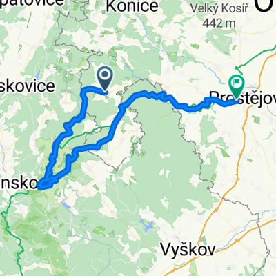
Protivanov-Vranovice č.3
A cycling route starting in Protivanov, Olomoucký kraj, Czechia.
Overview
About this route
The route includes the Prostějov-Protivanov bike bus.
- -:--
- Duration
- 48.4 km
- Distance
- 324 m
- Ascent
- 759 m
- Descent
- ---
- Avg. speed
- ---
- Max. altitude
Route quality
Waytypes & surfaces along the route
Waytypes
Track
29.5 km
(61 %)
Road
8.2 km
(17 %)
Surfaces
Paved
13.1 km
(27 %)
Unpaved
17.4 km
(36 %)
Ground
9.7 km
(20 %)
Asphalt
7.3 km
(15 %)
Continue with Bikemap
Use, edit, or download this cycling route
You would like to ride Protivanov-Vranovice č.3 or customize it for your own trip? Here is what you can do with this Bikemap route:
Free features
- Save this route as favorite or in collections
- Copy & plan your own version of this route
- Sync your route with Garmin or Wahoo
Premium features
Free trial for 3 days, or one-time payment. More about Bikemap Premium.
- Navigate this route on iOS & Android
- Export a GPX / KML file of this route
- Create your custom printout (try it for free)
- Download this route for offline navigation
Discover more Premium features.
Get Bikemap PremiumFrom our community
Other popular routes starting in Protivanov
 skalky
- Distance
- 21.2 km
- Ascent
- 470 m
- Descent
- 472 m
- Location
- Protivanov, Olomoucký kraj, Czechia
 Protivanov-Vranovice č.4
- Distance
- 63.9 km
- Ascent
- 414 m
- Descent
- 853 m
- Location
- Protivanov, Olomoucký kraj, Czechia
 Moravský Kras
- Distance
- 45.8 km
- Ascent
- 566 m
- Descent
- 567 m
- Location
- Protivanov, Olomoucký kraj, Czechia
 4h zvlneno
- Distance
- 128.1 km
- Ascent
- 1,090 m
- Descent
- 1,089 m
- Location
- Protivanov, Olomoucký kraj, Czechia
 Macocha 1.
- Distance
- 71.2 km
- Ascent
- 388 m
- Descent
- 829 m
- Location
- Protivanov, Olomoucký kraj, Czechia
 Suchy Trasa I
- Distance
- 40.3 km
- Ascent
- 793 m
- Descent
- 790 m
- Location
- Protivanov, Olomoucký kraj, Czechia
 Suchý Trasa II
- Distance
- 48.2 km
- Ascent
- 660 m
- Descent
- 655 m
- Location
- Protivanov, Olomoucký kraj, Czechia
 Protivanov dětská
- Distance
- 16.5 km
- Ascent
- 264 m
- Descent
- 261 m
- Location
- Protivanov, Olomoucký kraj, Czechia
Open it in the app