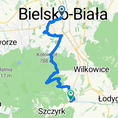
Łazy przez Jasienicę
- 16.8 km
- 183 m
- 143 m
- Bielsko-Biala, Silesian Voivodeship, Poland
A cycling route starting in Bielsko-Biala, Silesian Voivodeship, Poland.
Overview
created this 16 years ago
Route quality
Road
35.3 km
(51 %)
Quiet road
20.1 km
(29 %)
Paved
61 km
(88 %)
Unpaved
1.4 km
(2 %)
Asphalt
61 km
(88 %)
Ground
1.4 km
(2 %)
Undefined
6.9 km
(10 %)
Route highlights

źródełko z woda w straconce, ludzie tu przyjezdzaja z baniakami i biora wode do domu, dobre miejsce zeby uzupelnic wode w bidonie

widok na droge ktora jedzie sie na przegibek

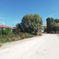
widok na domki na dole

jakis pomnik na tle gor

bar dla spragnionych rowerzystow na szczycie przegibka

widok na zar na szczycie widac cel wyprawy

widok z mostku 2

ludki na spadochronach

kolejka na Żar

widok na zar i trase kolejki

widok na trase downhilowa

widok w druga strone

zbiornik niestety pusty ale widac za to ze calkiem gleboki

turysci na tle gor

kolejka

widok z mostka

droga na/z przegibek tu akurat plaska...

budynek kolejki linowej na szyndzielnie

kolejne źródełko z woda pitna akurat jakis gosc tankuje baniak

lotnisko sportowe, w tle widac hangar na szybowce i reszte sprzetu
Continue with Bikemap
You would like to ride bb, przegibek, żar, szyndzielnia, lotnisko or customize it for your own trip? Here is what you can do with this Bikemap route:
Free trial for 3 days, or one-time payment. More about Bikemap Premium.
Discover more Premium features.
Get Bikemap PremiumFrom our community
Open it in the app