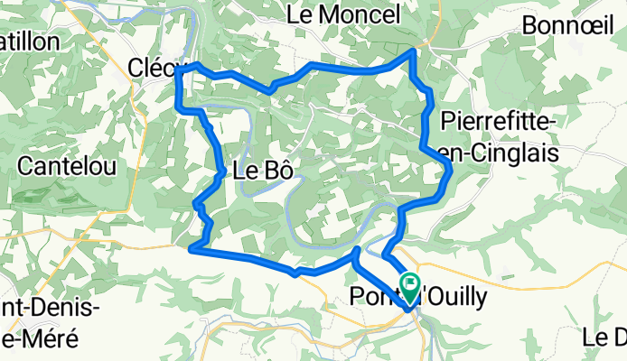
Petite boucle en Suisse Normande
A cycling route starting in Clécy, Normandy, France.
Overview
About this route
Two climbs-descent with some of the highest elevation changes in Normandy: 250 m
- -:--
- Duration
- 22.4 km
- Distance
- 460 m
- Ascent
- 460 m
- Descent
- ---
- Avg. speed
- ---
- Max. altitude
Route quality
Waytypes & surfaces along the route
Waytypes
Road
8.3 km
(37 %)
Quiet road
6.9 km
(31 %)
Undefined
7.2 km
(32 %)
Surfaces
Paved
2.5 km
(11 %)
Asphalt
2.5 km
(11 %)
Undefined
19.9 km
(89 %)
Continue with Bikemap
Use, edit, or download this cycling route
You would like to ride Petite boucle en Suisse Normande or customize it for your own trip? Here is what you can do with this Bikemap route:
Free features
- Save this route as favorite or in collections
- Copy & plan your own version of this route
- Sync your route with Garmin or Wahoo
Premium features
Free trial for 3 days, or one-time payment. More about Bikemap Premium.
- Navigate this route on iOS & Android
- Export a GPX / KML file of this route
- Create your custom printout (try it for free)
- Download this route for offline navigation
Discover more Premium features.
Get Bikemap PremiumFrom our community
Other popular routes starting in Clécy
Petite boucle en Suisse Normande- Distance
- 22.4 km
- Ascent
- 460 m
- Descent
- 460 m
- Location
- Clécy, Normandy, France
Place du Tripot, Clécy à Esplanade Jean-Marie Louvel, Caen- Distance
- 39.8 km
- Ascent
- 56 m
- Descent
- 125 m
- Location
- Clécy, Normandy, France
Clecy to Caen- Distance
- 77.1 km
- Ascent
- 83 m
- Descent
- 79 m
- Location
- Clécy, Normandy, France
Parcours 100km Week-end Suisse Normande- Distance
- 97.6 km
- Ascent
- 829 m
- Descent
- 810 m
- Location
- Clécy, Normandy, France
3éme étape Calva Camembert- Distance
- 86.3 km
- Ascent
- 774 m
- Descent
- 774 m
- Location
- Clécy, Normandy, France
2016 Sept Day 3 99km 710m- Distance
- 97.8 km
- Ascent
- 633 m
- Descent
- 645 m
- Location
- Clécy, Normandy, France
Clécy - Gacé (Tour du Pays d'Auge, Etape 4)- Distance
- 72.9 km
- Ascent
- 715 m
- Descent
- 484 m
- Location
- Clécy, Normandy, France
Le bas de rouvrou - Hameau de neuville- Distance
- 181.7 km
- Ascent
- 1,407 m
- Descent
- 1,469 m
- Location
- Clécy, Normandy, France
Open it in the app

