

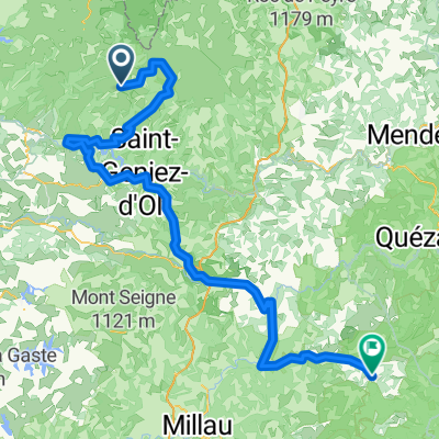
7.etapa St Chely d Aubrac - Le Malzieu-Ville
A cycling route starting in Laguiole, Occitanie, France.
Overview
About this route
The route is suitable for all types of bicycles. However, for road bikes it is necessary to continue in Montgrousset on the D900 towards the turnoff to Marchastel (skip the route through the grassy plains). Further beyond the village of Rieutort d'Aubrac, continue on the D987 to Malbouzon, where it joins the D73 (skip the 'Pilgrims' pathway'). Nice camping / hot water without any problems / pleasant sanitary facilities / the socket with grounding is only in the kitchenette (for using the kettle) / in the washroom, there are only sockets with two holes, namely for lamps over the sink (for mobiles, shavers, etc.) / Possibility to also sleep in cabins, but I have no details on this type of accommodation. There is no nice mobile signal.
- -:--
- Duration
- 80.6 km
- Distance
- 934 m
- Ascent
- 877 m
- Descent
- ---
- Avg. speed
- ---
- Max. altitude

Route quality
Waytypes & surfaces along the route
Waytypes
Road
20.2 km
(25 %)
Quiet road
16.9 km
(21 %)
Surfaces
Paved
48.4 km
(60 %)
Unpaved
3.2 km
(4 %)
Asphalt
48.4 km
(60 %)
Gravel
2.4 km
(3 %)
Route highlights
Points of interest along the route
Point of interest after 16.8 km
OBED
Point of interest after 24.7 km
Zacatek cesty přes louky (pozor na občasné šrapnely" od krav). Vjezd ze silnice na louku je přes dva ostnaté ploty, které se dají bez problému otevřít. Dle mých kamarádů je tento způsob cestování na Slovensku zcela normální. Nutno však podotknout, že průměrná rychlost na tomto úseku je cca 5 km/h - větší část se jde chůzí)
Point of interest after 26.4 km
Rozhled do krajiny
Point of interest after 29.1 km
Překonávání ostnatého plotu. Kola jsem si přes něj podávali a na druhou stranu jsem ho museli podlízt způsobem plazením vpřed :-)
Point of interest after 30 km
vrátka z ostnatého plotu
Point of interest after 30.3 km
Konec cetsy přes nádhernou pláň. Opět vrátka z ostnatého plotu - není problém si je otevřít a pak zavřít.
Point of interest after 35.2 km
Začátek "Poutní cesty", která se však jde z druhé strany. Pozor, jedná se cestu určenou pro horská a tracková kola. Silniční kola to mohou bez problému objet po silnici do Malbouzen-u.
Point of interest after 38 km
Konec "Poutní stezky", kde se musí občas sesednout z kola.
Point of interest after 55.3 km
OBED - moznost zaparkovat auto
Continue with Bikemap
Use, edit, or download this cycling route
You would like to ride 7.etapa St Chely d Aubrac - Le Malzieu-Ville or customize it for your own trip? Here is what you can do with this Bikemap route:
Free features
- Save this route as favorite or in collections
- Copy & plan your own version of this route
- Split it into stages to create a multi-day tour
- Sync your route with Garmin or Wahoo
Premium features
Free trial for 3 days, or one-time payment. More about Bikemap Premium.
- Navigate this route on iOS & Android
- Export a GPX / KML file of this route
- Create your custom printout (try it for free)
- Download this route for offline navigation
Discover more Premium features.
Get Bikemap PremiumFrom our community
Other popular routes starting in Laguiole
 2014 Ride Day 99 - St-Chély-d'Aubrac to Marvejols
- Distance
- 44.7 km
- Ascent
- 673 m
- Descent
- 856 m
- Location
- Laguiole, Occitanie, France
 Nasbidaniel2
- Distance
- 60.7 km
- Ascent
- 627 m
- Descent
- 627 m
- Location
- Laguiole, Occitanie, France
 TAP J 1
- Distance
- 78.4 km
- Ascent
- 900 m
- Descent
- 1,474 m
- Location
- Laguiole, Occitanie, France
 étape 5
- Distance
- 105 km
- Ascent
- 1,228 m
- Descent
- 1,265 m
- Location
- Laguiole, Occitanie, France
 09-MassifCentral
- Distance
- 60.8 km
- Ascent
- 509 m
- Descent
- 1,057 m
- Location
- Laguiole, Occitanie, France
 Ride Day 32—13 Oct 2005—48260 Recoules D'Aubrac (Nasbinals) to 15300 Murat
- Distance
- 67.6 km
- Ascent
- 587 m
- Descent
- 757 m
- Location
- Laguiole, Occitanie, France
 Aveyron-Tag1--4-0719 Runde angepasst
- Distance
- 142.3 km
- Ascent
- 1,759 m
- Descent
- 1,875 m
- Location
- Laguiole, Occitanie, France
 7.etapa St Chely d Aubrac - Le Malzieu-Ville
- Distance
- 80.6 km
- Ascent
- 934 m
- Descent
- 877 m
- Location
- Laguiole, Occitanie, France
Open it in the app