Suchý Trasa II
- 48.2 km
- 660 m
- 655 m
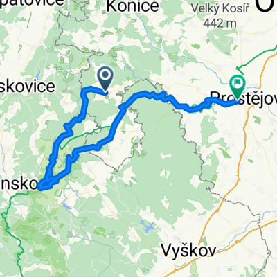
- Protivanov, Olomoucký kraj, Czechia
A cycling route starting in Protivanov, Olomoucký kraj, Czechia.
Overview
The route includes the cycling bus Prostějov-Protivanov.
created this 13 years ago
Route quality
Track
33.2 km
(52 %)
Road
19.8 km
(31 %)
Paved
40.3 km
(63 %)
Unpaved
8.3 km
(13 %)
Asphalt
28.1 km
(44 %)
Paved (undefined)
12.1 km
(19 %)
Route highlights
Sloupsko-Šošůvské jeskyně
"Ostrovská" propast
Jeskyně Balcarka
Vysílač "Kojál"
Zřícenina hradu Kuchlov
Zřícenina Hrádek
Letecké muzeum Vyškov
Continue with Bikemap
You would like to ride Protivanov-Vranovice č.4 or customize it for your own trip? Here is what you can do with this Bikemap route:
Free trial for 3 days, or one-time payment. More about Bikemap Premium.
Discover more Premium features.
Get Bikemap PremiumFrom our community
Open it in the app