
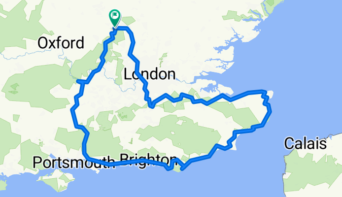
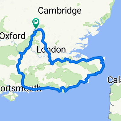
Route to Reading
A cycling route starting in Totternhoe, England, United Kingdom.
Overview
About this route
- 44 h 53 min
- Duration
- 737.9 km
- Distance
- 5,173 m
- Ascent
- 5,177 m
- Descent
- 16.4 km/h
- Avg. speed
- 251 m
- Max. altitude

Route quality
Waytypes & surfaces along the route
Waytypes
Quiet road
339.4 km
(46 %)
Cycleway
236.1 km
(32 %)
Surfaces
Paved
487 km
(66 %)
Unpaved
36.9 km
(5 %)
Asphalt
464.8 km
(63 %)
Gravel
22.1 km
(3 %)
Continue with Bikemap
Use, edit, or download this cycling route
You would like to ride Route to Reading or customize it for your own trip? Here is what you can do with this Bikemap route:
Free features
- Save this route as favorite or in collections
- Copy & plan your own version of this route
- Split it into stages to create a multi-day tour
- Sync your route with Garmin or Wahoo
Premium features
Free trial for 3 days, or one-time payment. More about Bikemap Premium.
- Navigate this route on iOS & Android
- Export a GPX / KML file of this route
- Create your custom printout (try it for free)
- Download this route for offline navigation
Discover more Premium features.
Get Bikemap PremiumFrom our community
Other popular routes starting in Totternhoe
 Route to Reading
- Distance
- 737.9 km
- Ascent
- 5,173 m
- Descent
- 5,177 m
- Location
- Totternhoe, England, United Kingdom
 darbas namai
- Distance
- 11.2 km
- Ascent
- 73 m
- Descent
- 52 m
- Location
- Totternhoe, England, United Kingdom
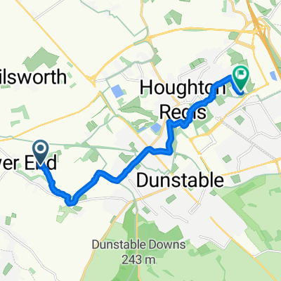
 Route to 73 Conway Close, Dunstable
- Distance
- 12.5 km
- Ascent
- 88 m
- Descent
- 91 m
- Location
- Totternhoe, England, United Kingdom
 3–4 Ellesmere Close, Dunstable to 15 Church Road, Dunstable
- Distance
- 10.7 km
- Ascent
- 40 m
- Descent
- 41 m
- Location
- Totternhoe, England, United Kingdom
 Slow ride in Dunstable
- Distance
- 10.2 km
- Ascent
- 53 m
- Descent
- 52 m
- Location
- Totternhoe, England, United Kingdom
 Sewell Lane, Sewell, Dunstable to 227 Sharpenhoe Road, Luton
- Distance
- 22.6 km
- Ascent
- 346 m
- Descent
- 312 m
- Location
- Totternhoe, England, United Kingdom
Open it in the app