

4 etapa tasenbach(AUS)-canizei(ITA)
A cycling route starting in Heinfels, Tyrol, Austria.
Overview
About this route
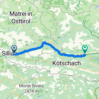
Stage 4 Tassenbach (AUT) - Canazei (ITA) 109.192 km
- -:--
- Duration
- 109.2 km
- Distance
- 2,079 m
- Ascent
- 1,709 m
- Descent
- ---
- Avg. speed
- ---
- Max. altitude
Route quality
Waytypes & surfaces along the route
Waytypes
Track
2.2 km
(2 %)
Quiet road
1.1 km
(1 %)
Surfaces
Paved
100.5 km
(92 %)
Unpaved
3.3 km
(3 %)
Asphalt
100.5 km
(92 %)
Unpaved (undefined)
1.1 km
(1 %)
Continue with Bikemap
Use, edit, or download this cycling route
You would like to ride 4 etapa tasenbach(AUS)-canizei(ITA) or customize it for your own trip? Here is what you can do with this Bikemap route:
Free features
- Save this route as favorite or in collections
- Copy & plan your own version of this route
- Split it into stages to create a multi-day tour
- Sync your route with Garmin or Wahoo
Premium features
Free trial for 3 days, or one-time payment. More about Bikemap Premium.
- Navigate this route on iOS & Android
- Export a GPX / KML file of this route
- Create your custom printout (try it for free)
- Download this route for offline navigation
Discover more Premium features.
Get Bikemap PremiumFrom our community
Other popular routes starting in Heinfels
 Drauraweg
- Distance
- 258.2 km
- Ascent
- 290 m
- Descent
- 990 m
- Location
- Heinfels, Tyrol, Austria
 Drauraweg
- Distance
- 258.5 km
- Ascent
- 280 m
- Descent
- 981 m
- Location
- Heinfels, Tyrol, Austria
 From Heinfels to Lienz
- Distance
- 30.9 km
- Ascent
- 370 m
- Descent
- 776 m
- Location
- Heinfels, Tyrol, Austria
 solo_23_2_3_Tassenbach - Brixen
- Distance
- 105.7 km
- Ascent
- 1,184 m
- Descent
- 1,720 m
- Location
- Heinfels, Tyrol, Austria
 O07LienzerDolomitenGreifenburgBadesee
- Distance
- 69.3 km
- Ascent
- 747 m
- Descent
- 1,231 m
- Location
- Heinfels, Tyrol, Austria
 Überschreitung Defreggental ins Winkltal
- Distance
- 95.4 km
- Ascent
- 2,484 m
- Descent
- 2,484 m
- Location
- Heinfels, Tyrol, Austria
 AT - Day 8 - Weissensee
- Distance
- 74 km
- Ascent
- 445 m
- Descent
- 583 m
- Location
- Heinfels, Tyrol, Austria
 Tassenbacher Speicher, Strassen to Arnbacher Loipenweg, Sillian
- Distance
- 5.3 km
- Ascent
- 92 m
- Descent
- 77 m
- Location
- Heinfels, Tyrol, Austria
Open it in the app