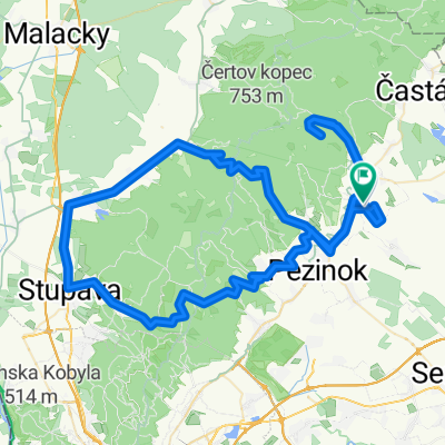
Šúrska 4 do Komenského 2
A cycling route starting in Modra, Bratislavský kraj, Slovak Republic.
Overview
About this route
- 3 h 59 min
- Duration
- 44.8 km
- Distance
- 412 m
- Ascent
- 446 m
- Descent
- 11.2 km/h
- Avg. speed
- 205 m
- Max. altitude
Route quality
Waytypes & surfaces along the route
Waytypes
Quiet road
13.4 km
(30 %)
Track
11.1 km
(25 %)
Surfaces
Paved
25.3 km
(57 %)
Unpaved
9.7 km
(22 %)
Asphalt
21.2 km
(47 %)
Gravel
5.9 km
(13 %)
Continue with Bikemap
Use, edit, or download this cycling route
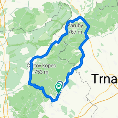
You would like to ride Šúrska 4 do Komenského 2 or customize it for your own trip? Here is what you can do with this Bikemap route:
Free features
- Save this route as favorite or in collections
- Copy & plan your own version of this route
- Sync your route with Garmin or Wahoo
Premium features
Free trial for 3 days, or one-time payment. More about Bikemap Premium.
- Navigate this route on iOS & Android
- Export a GPX / KML file of this route
- Create your custom printout (try it for free)
- Download this route for offline navigation
Discover more Premium features.
Get Bikemap PremiumFrom our community
Other popular routes starting in Modra
- Dubova-Biely kriz a spat
- Distance
- 63 km
- Ascent
- 2,482 m
- Descent
- 2,512 m
- Location
- Modra, Bratislavský kraj, Slovak Republic
- Malé karpaty the best of
- Distance
- 61.7 km
- Ascent
- 1,295 m
- Descent
- 1,296 m
- Location
- Modra, Bratislavský kraj, Slovak Republic
- Nádražná do Suchá nad Parnou
- Distance
- 43.4 km
- Ascent
- 613 m
- Descent
- 584 m
- Location
- Modra, Bratislavský kraj, Slovak Republic
- Male Karpaty Bike trip.
- Distance
- 64.1 km
- Ascent
- 1,265 m
- Descent
- 1,254 m
- Location
- Modra, Bratislavský kraj, Slovak Republic
- bike tour through District of Pezinok
- Distance
- 25.8 km
- Ascent
- 245 m
- Descent
- 245 m
- Location
- Modra, Bratislavský kraj, Slovak Republic
- Zochova velky okruh
- Distance
- 56.1 km
- Ascent
- 1,195 m
- Descent
- 1,196 m
- Location
- Modra, Bratislavský kraj, Slovak Republic
- From Modra to Bratislava
- Distance
- 40.6 km
- Ascent
- 693 m
- Descent
- 716 m
- Location
- Modra, Bratislavský kraj, Slovak Republic
- Čermákova lúka
- Distance
- 12.7 km
- Ascent
- 1,016 m
- Descent
- 1,018 m
- Location
- Modra, Bratislavský kraj, Slovak Republic
Open it in the app