

Dresden-Freital-Dippoldiswalde-Dresden
A cycling route starting in Dresden, Saxony, Germany.
Overview
About this route
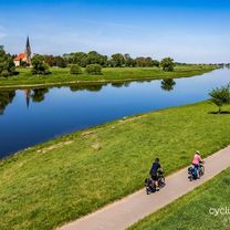
Ride the route, because there are a few beautiful climbs and you can enjoy the scenery during the descents. Parts of the route have also been ridden during the cycling festival of the Sächsische Zeitung.
- -:--
- Duration
- 64.1 km
- Distance
- 882 m
- Ascent
- 886 m
- Descent
- ---
- Avg. speed
- 432 m
- Max. altitude
Route quality
Waytypes & surfaces along the route
Waytypes
Road
19.9 km
(31 %)
Quiet road
3.2 km
(5 %)
Surfaces
Paved
55.7 km
(87 %)
Unpaved
1.9 km
(3 %)
Asphalt
55.7 km
(87 %)
Gravel
1.3 km
(2 %)
Continue with Bikemap
Use, edit, or download this cycling route
You would like to ride Dresden-Freital-Dippoldiswalde-Dresden or customize it for your own trip? Here is what you can do with this Bikemap route:
Free features
- Save this route as favorite or in collections
- Copy & plan your own version of this route
- Sync your route with Garmin or Wahoo
Premium features
Free trial for 3 days, or one-time payment. More about Bikemap Premium.
- Navigate this route on iOS & Android
- Export a GPX / KML file of this route
- Create your custom printout (try it for free)
- Download this route for offline navigation
Discover more Premium features.
Get Bikemap PremiumFrom our community
Other popular routes starting in Dresden
 rechts und linkselbische Taeler
- Distance
- 59.5 km
- Ascent
- 677 m
- Descent
- 673 m
- Location
- Dresden, Saxony, Germany
 Dresden - Berlin Zehlendorf
- Distance
- 205.9 km
- Ascent
- 367 m
- Descent
- 440 m
- Location
- Dresden, Saxony, Germany
 Elbe-Runde_2
- Distance
- 27.2 km
- Ascent
- 78 m
- Descent
- 78 m
- Location
- Dresden, Saxony, Germany
 Nachtcruise DLC 14
- Distance
- 16.8 km
- Ascent
- 64 m
- Descent
- 59 m
- Location
- Dresden, Saxony, Germany
 .::BJ::. ||| Frische Waldluft, heiße Panoramawege, Talsperren und Bäche |||: (via Coschütz - Börnchen - Talsperre Malter - Talsperre Klingenberg - Tharandter Wa
- Distance
- 92.1 km
- Ascent
- 669 m
- Descent
- 667 m
- Location
- Dresden, Saxony, Germany
 Rehbocktal
- Distance
- 44.1 km
- Ascent
- 405 m
- Descent
- 405 m
- Location
- Dresden, Saxony, Germany
 Stoppomat, Landberg & Klingenberg
- Distance
- 74.7 km
- Ascent
- 477 m
- Descent
- 478 m
- Location
- Dresden, Saxony, Germany
 Elbe Cycle Route - Dresden to Magdeburg
- Distance
- 312.5 km
- Ascent
- 538 m
- Descent
- 597 m
- Location
- Dresden, Saxony, Germany
Open it in the app