
subway ride 2
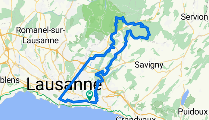
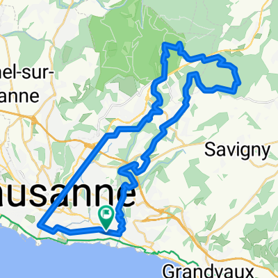
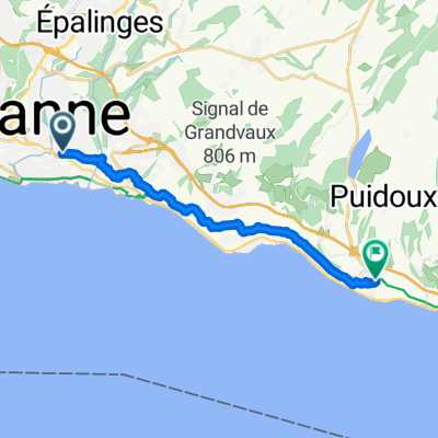
A cycling route starting in Pully, Canton of Vaud, Switzerland.
Overview
About this route
- -:--
- Duration
- 32.5 km
- Distance
- 610 m
- Ascent
- 610 m
- Descent
- ---
- Avg. speed
- ---
- Max. altitude
Continue with Bikemap
Use, edit, or download this cycling route
You would like to ride subway ride 2 or customize it for your own trip? Here is what you can do with this Bikemap route:
Free features
- Save this route as favorite or in collections
- Copy & plan your own version of this route
- Sync your route with Garmin or Wahoo
Premium features
Free trial for 3 days, or one-time payment. More about Bikemap Premium.
- Navigate this route on iOS & Android
- Export a GPX / KML file of this route
- Create your custom printout (try it for free)
- Download this route for offline navigation
Discover more Premium features.
Get Bikemap PremiumFrom our community
Other popular routes starting in Pully
 Ride From Pully To Checker
- Distance
- 27 km
- Ascent
- 275 m
- Descent
- 304 m
- Location
- Pully, Canton of Vaud, Switzerland
 pully . corniche
- Distance
- 30.7 km
- Ascent
- 470 m
- Descent
- 470 m
- Location
- Pully, Canton of Vaud, Switzerland
 Bellevue/Avenir Jour Un Bellevue 2 Jour 1 Retour Maison
- Distance
- 1.4 km
- Ascent
- 0 m
- Descent
- 10 m
- Location
- Pully, Canton of Vaud, Switzerland
 subway ride
- Distance
- 19 km
- Ascent
- 501 m
- Descent
- 507 m
- Location
- Pully, Canton of Vaud, Switzerland
 Avenue Samson Reymondin 6–12, Pully to Avenue Samson Reymondin 15, Pully
- Distance
- 27.7 km
- Ascent
- 595 m
- Descent
- 548 m
- Location
- Pully, Canton of Vaud, Switzerland
 subway ride 2
- Distance
- 32.5 km
- Ascent
- 610 m
- Descent
- 610 m
- Location
- Pully, Canton of Vaud, Switzerland
 Avenue Étienne Guillemin, Pully à Rue du Bourg de Plaît, Chexbres
- Distance
- 12.6 km
- Ascent
- 414 m
- Descent
- 347 m
- Location
- Pully, Canton of Vaud, Switzerland
 Supersonic route in Lausanne
- Distance
- 61.9 km
- Ascent
- 810 m
- Descent
- 813 m
- Location
- Pully, Canton of Vaud, Switzerland
Open it in the app