

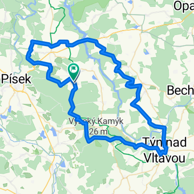
Etapa 049C (Písek - Vyšší Brod)
A cycling route starting in Písek, Jihočeský kraj, Czechia.
Overview
About this route
Vuelta a Europa occidental. Etapa 49
Písek - Albrechtice nad Vltavou - Všemyslice - Týn nad Vltavou - Hluboká nad Vltavou - České Budějovice - Boršov nad Vltavou - Kamenný Újezd - Zlatá Koruna - Český Krumlov - Rožmitál na Šumavě - Rožmberk nad Vltavou - Vyšší Brod
128.9 km
2430 m desnivel acumulado positivo
- 8 h 43 min
- Duration
- 134.8 km
- Distance
- 2,582 m
- Ascent
- 2,380 m
- Descent
- 15.5 km/h
- Avg. speed
- 728 m
- Max. altitude

Route quality
Waytypes & surfaces along the route
Waytypes
Quiet road
44.5 km
(33 %)
Road
35.1 km
(26 %)
Surfaces
Paved
97.1 km
(72 %)
Unpaved
5.4 km
(4 %)
Asphalt
91.7 km
(68 %)
Gravel
5.4 km
(4 %)
Route highlights
Points of interest along the route
Point of interest after 33.6 km
Městské muzeum Týn nad Vltavou
Point of interest after 59.8 km
Státní zámek Hluboká
Point of interest after 60.4 km
Kostel svatého Jana Nepomuckého
Point of interest after 71.5 km
Černá věž
Point of interest after 71.7 km
Samsonova kašna
Point of interest after 71.8 km
Magistrát města České Budějovice
Point of interest after 93.7 km
Klášter Zlatá Koruna
Point of interest after 101.8 km
Budějovické bráně
Point of interest after 102.5 km
Státní hrad a zámek Český Krumlov
Point of interest after 102.5 km
Lazebnický most
Point of interest after 102.7 km
Egon Schiele Art Centrum
Point of interest after 103 km
Kašna a morový sloup
Point of interest after 103 km
Historické Staré Město
Point of interest after 103.1 km
Latrán
Point of interest after 127.9 km
Hrad Rožmberk
Accommodation after 134.8 km
Kemp Pod Hrází
Continue with Bikemap
Use, edit, or download this cycling route
You would like to ride Etapa 049C (Písek - Vyšší Brod) or customize it for your own trip? Here is what you can do with this Bikemap route:
Free features
- Save this route as favorite or in collections
- Copy & plan your own version of this route
- Split it into stages to create a multi-day tour
- Sync your route with Garmin or Wahoo
Premium features
Free trial for 3 days, or one-time payment. More about Bikemap Premium.
- Navigate this route on iOS & Android
- Export a GPX / KML file of this route
- Create your custom printout (try it for free)
- Download this route for offline navigation
Discover more Premium features.
Get Bikemap PremiumFrom our community
Other popular routes starting in Písek
 Apalucha Písek
- Distance
- 39.5 km
- Ascent
- 218 m
- Descent
- 216 m
- Location
- Písek, Jihočeský kraj, Czechia
 TK Olymp 1995 6/9
- Distance
- 68.5 km
- Ascent
- 468 m
- Descent
- 513 m
- Location
- Písek, Jihočeský kraj, Czechia
 Moldauradweg B4 Pisek nach Budweis HBF
- Distance
- 69.9 km
- Ascent
- 365 m
- Descent
- 338 m
- Location
- Písek, Jihočeský kraj, Czechia
 Písecké hory
- Distance
- 16.6 km
- Ascent
- 333 m
- Descent
- 416 m
- Location
- Písek, Jihočeský kraj, Czechia
 Kluky_Tyn_Podolak
- Distance
- 70.4 km
- Ascent
- 772 m
- Descent
- 776 m
- Location
- Písek, Jihočeský kraj, Czechia
 Malý okruh Píseckými horami
- Distance
- 17.2 km
- Ascent
- 220 m
- Descent
- 220 m
- Location
- Písek, Jihočeský kraj, Czechia
 Etapa 049C (Písek - Vyšší Brod)
- Distance
- 134.8 km
- Ascent
- 2,582 m
- Descent
- 2,380 m
- Location
- Písek, Jihočeský kraj, Czechia
 Písek_Rožmitál pod Třemšínem
- Distance
- 61.3 km
- Ascent
- 969 m
- Descent
- 800 m
- Location
- Písek, Jihočeský kraj, Czechia
Open it in the app