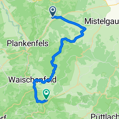
Breitenlesau - Pottenstein über schattige Waldwege
- 24.7 km
- 422 m
- 448 m
- Plankenfels, Bavaria, Germany
A cycling route starting in Plankenfels, Bavaria, Germany.
Overview
Nach dem Schnitzel in Breitenlesau geht es erst über Feldwege, dann in abschüssigen Waldwegen runter nach Waischenfeld.
Von dort entlang der Wiesent wieder im Schutz des Waldes.
Machmal muss man kurz auf die Straße und kann dann wieder zurück in den Wald.
Ab Behringersmühle wieder viel Wald.
Alles einfache Waldwege, keine Wurzeln, keine Schiebestrecken.
created this 13 years ago
Route quality
Track
9.6 km
(39 %)
Quiet road
5.7 km
(23 %)
Paved
7.9 km
(32 %)
Unpaved
11.1 km
(45 %)
Asphalt
7.6 km
(31 %)
Gravel
4.4 km
(18 %)
Continue with Bikemap
You would like to ride Breitenlesau - Pottenstein über schattige Waldwege or customize it for your own trip? Here is what you can do with this Bikemap route:
Free trial for 3 days, or one-time payment. More about Bikemap Premium.
Discover more Premium features.
Get Bikemap PremiumFrom our community
Open it in the app