

Turček - Skalka - ZH
A cycling route starting in Kremnica, Banská Bystrica Region, Slovakia.
Overview
About this route
- -:--
- Duration
- 53.6 km
- Distance
- 694 m
- Ascent
- 1,166 m
- Descent
- ---
- Avg. speed
- ---
- Max. altitude
Route quality
Waytypes & surfaces along the route
Waytypes
Track
39.1 km
(73 %)
Road
10.7 km
(20 %)
Surfaces
Paved
10.7 km
(20 %)
Unpaved
29.5 km
(55 %)
Gravel
13.4 km
(25 %)
Unpaved (undefined)
12.3 km
(23 %)
Route highlights
Points of interest along the route

Photo after 10 km
Pod Vlčím vrchom, pohľad smerom na vysielač

Photo after 15.3 km
Gőrgeiho tunel
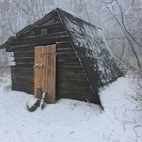
Point of interest after 17.6 km
"Pekná vyhliadka" Pozn. Na mape chýba lyž. stredisko Skalka Arena
Point of interest after 17.6 km
vysielač Skalka
Point of interest after 29.1 km
Lyžiarsky vlek Sielnica-Brestová
Continue with Bikemap
Use, edit, or download this cycling route
You would like to ride Turček - Skalka - ZH or customize it for your own trip? Here is what you can do with this Bikemap route:
Free features
- Save this route as favorite or in collections
- Copy & plan your own version of this route
- Sync your route with Garmin or Wahoo
Premium features
Free trial for 3 days, or one-time payment. More about Bikemap Premium.
- Navigate this route on iOS & Android
- Export a GPX / KML file of this route
- Create your custom printout (try it for free)
- Download this route for offline navigation
Discover more Premium features.
Get Bikemap PremiumFrom our community
Other popular routes starting in Kremnica
 Ihráč píla, hostinec, Ihráč.
- Distance
- 29.8 km
- Ascent
- 1,067 m
- Descent
- 939 m
- Location
- Kremnica, Banská Bystrica Region, Slovakia
 Že nedeľa ""skalka •tour""
- Distance
- 13 km
- Ascent
- 33 m
- Descent
- 271 m
- Location
- Kremnica, Banská Bystrica Region, Slovakia
 Tri krize - Ihracska pila - Trnava hora
- Distance
- 17 km
- Ascent
- 20 m
- Descent
- 937 m
- Location
- Kremnica, Banská Bystrica Region, Slovakia
 Rudná Poľana - Badín (spevnená)
- Distance
- 9.8 km
- Ascent
- 29 m
- Descent
- 778 m
- Location
- Kremnica, Banská Bystrica Region, Slovakia
 Slovensko, Banská Bystrica do Cesta bez názvu, Banská Bystrica
- Distance
- 8.1 km
- Ascent
- 736 m
- Descent
- 818 m
- Location
- Kremnica, Banská Bystrica Region, Slovakia
 Kráľova studňa_1
- Distance
- 51.8 km
- Ascent
- 1,052 m
- Descent
- 1,052 m
- Location
- Kremnica, Banská Bystrica Region, Slovakia
 Tri Kríže - Horné Pršany (žltá)
- Distance
- 6.6 km
- Ascent
- 197 m
- Descent
- 725 m
- Location
- Kremnica, Banská Bystrica Region, Slovakia
 Pohodová cesta v
- Distance
- 22.6 km
- Ascent
- 1,370 m
- Descent
- 1,364 m
- Location
- Kremnica, Banská Bystrica Region, Slovakia
Open it in the app