

Tiger and Muesli
A cycling route starting in Mainz, Rhineland-Palatinate, Germany.
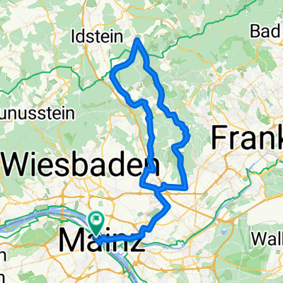
Overview
About this route
Gemütliche Runde mit "Anstieg" zum Bismarkturm incl. Tiershow ;-)
Teilweise Verschmutzung der Fahrbahn durch Landwirtschaft bzw. Baufahrzeuge
- -:--
- Duration
- 59.2 km
- Distance
- 621 m
- Ascent
- 565 m
- Descent
- ---
- Avg. speed
- 253 m
- Max. altitude

Route quality
Waytypes & surfaces along the route
Waytypes
Road
13 km
(22 %)
Path
10.7 km
(18 %)
Surfaces
Paved
49.7 km
(84 %)
Unpaved
1.8 km
(3 %)
Asphalt
49.1 km
(83 %)
Gravel
1.2 km
(2 %)
Continue with Bikemap
Use, edit, or download this cycling route
You would like to ride Tiger and Muesli or customize it for your own trip? Here is what you can do with this Bikemap route:
Free features
- Save this route as favorite or in collections
- Copy & plan your own version of this route
- Sync your route with Garmin or Wahoo
Premium features
Free trial for 3 days, or one-time payment. More about Bikemap Premium.
- Navigate this route on iOS & Android
- Export a GPX / KML file of this route
- Create your custom printout (try it for free)
- Download this route for offline navigation
Discover more Premium features.
Get Bikemap PremiumFrom our community
Other popular routes starting in Mainz
 Von Mainz nach Bad Homburg
- Distance
- 58.2 km
- Ascent
- 156 m
- Descent
- 66 m
- Location
- Mainz, Rhineland-Palatinate, Germany
 Runde über Lörzweiler
- Distance
- 34.5 km
- Ascent
- 241 m
- Descent
- 238 m
- Location
- Mainz, Rhineland-Palatinate, Germany
 Mainz-Lorsbachtal-Heftrich-Niedernhausen-Mainz
- Distance
- 82.4 km
- Ascent
- 719 m
- Descent
- 720 m
- Location
- Mainz, Rhineland-Palatinate, Germany
 Mainz Ingelheim-Nord Oestrich-winkel
- Distance
- 46.8 km
- Ascent
- 62 m
- Descent
- 60 m
- Location
- Mainz, Rhineland-Palatinate, Germany
 2015_07 - Mainz Gonsenheim - Budenheim - Mombach - Mainz
- Distance
- 14.9 km
- Ascent
- 71 m
- Descent
- 75 m
- Location
- Mainz, Rhineland-Palatinate, Germany
 Mainz-Kastel-Rüdesheim-Runde-74-km
- Distance
- 74.4 km
- Ascent
- 435 m
- Descent
- 435 m
- Location
- Mainz, Rhineland-Palatinate, Germany
 Kleiner Rundweg zwischen MzKastel und Wicker
- Distance
- 23.7 km
- Ascent
- 104 m
- Descent
- 87 m
- Location
- Mainz, Rhineland-Palatinate, Germany
 20190824 Schoppingroute
- Distance
- 15.7 km
- Ascent
- 72 m
- Descent
- 71 m
- Location
- Mainz, Rhineland-Palatinate, Germany
Open it in the app