

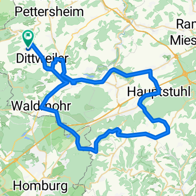
Schmittweiler-Dunzweiler Waldmohr Jägersburg
A cycling route starting in Altenkirchen, Rhineland-Palatinate, Germany.
Overview
About this route
Schöne Sonntagstour. Rosalinde hat sich am Berg wunderbar gehalten. Mal nicht nur Flachetappe
- -:--
- Duration
- 33 km
- Distance
- 329 m
- Ascent
- 329 m
- Descent
- ---
- Avg. speed
- ---
- Max. altitude
Route quality
Waytypes & surfaces along the route
Waytypes
Busy road
10 km
(30 %)
Quiet road
7.2 km
(22 %)
Surfaces
Paved
30.6 km
(93 %)
Unpaved
0.9 km
(3 %)
Asphalt
24.4 km
(74 %)
Paving stones
5.1 km
(15 %)
Continue with Bikemap
Use, edit, or download this cycling route
You would like to ride Schmittweiler-Dunzweiler Waldmohr Jägersburg or customize it for your own trip? Here is what you can do with this Bikemap route:
Free features
- Save this route as favorite or in collections
- Copy & plan your own version of this route
- Sync your route with Garmin or Wahoo
Premium features
Free trial for 3 days, or one-time payment. More about Bikemap Premium.
- Navigate this route on iOS & Android
- Export a GPX / KML file of this route
- Create your custom printout (try it for free)
- Download this route for offline navigation
Discover more Premium features.
Get Bikemap PremiumFrom our community
Other popular routes starting in Altenkirchen
 Kusel>Altenglan> Ramstein-Miesenbach>Hütschenhausen und Heim CLONED FROM ROUTE 1766172
- Distance
- 64.7 km
- Ascent
- 337 m
- Descent
- 337 m
- Location
- Altenkirchen, Rhineland-Palatinate, Germany
 Bechhofen Homburg Bexbach Münchwies Führt Werschweiler
- Distance
- 53.3 km
- Ascent
- 486 m
- Descent
- 471 m
- Location
- Altenkirchen, Rhineland-Palatinate, Germany
 Bitche Reichshoffen Woerth Hoffen Stundwiller Hatten Beinheim Rastastt Neuburgweiher Karlsruhe
- Distance
- 173.4 km
- Ascent
- 355 m
- Descent
- 544 m
- Location
- Altenkirchen, Rhineland-Palatinate, Germany
 Krottelbach Kusel Lauterecken Meisenheim Osterbrücken Werschweiler
- Distance
- 123.9 km
- Ascent
- 623 m
- Descent
- 615 m
- Location
- Altenkirchen, Rhineland-Palatinate, Germany
 Brücken Hauptstuhl Martinshöhe Lambsborn Waldmohr
- Distance
- 56.2 km
- Ascent
- 466 m
- Descent
- 466 m
- Location
- Altenkirchen, Rhineland-Palatinate, Germany
 Altenglan Lauterecken Hirschhorn
- Distance
- 109.1 km
- Ascent
- 426 m
- Descent
- 426 m
- Location
- Altenkirchen, Rhineland-Palatinate, Germany
 Schmittweiler-Dunzweiler Waldmohr Jägersburg
- Distance
- 33 km
- Ascent
- 329 m
- Descent
- 329 m
- Location
- Altenkirchen, Rhineland-Palatinate, Germany
 Elschbach Altenglan Lauterecken Hirschhorn
- Distance
- 108.3 km
- Ascent
- 445 m
- Descent
- 445 m
- Location
- Altenkirchen, Rhineland-Palatinate, Germany
Open it in the app