

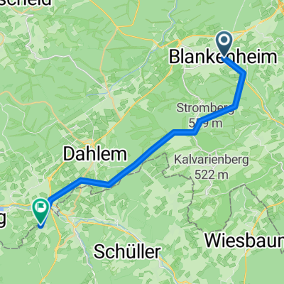
Ahrtour
A cycling route starting in Blankenheim, North Rhine-Westphalia, Germany.
Overview
About this route
- -:--
- Duration
- 83.8 km
- Distance
- 113 m
- Ascent
- 557 m
- Descent
- ---
- Avg. speed
- ---
- Max. altitude
Route highlights
Points of interest along the route
Accommodation after 5.7 km
Hotel Finkenberg Giesental 2 Blankenheim
Point of interest after 14.8 km
Alte Ölmühle - Gasthof
Point of interest after 20.5 km
Frings Mühle - Gaststätte
Point of interest after 26.1 km
SER Lachsräucherei
Point of interest after 37.1 km
Landgasthof Köbes
Point of interest after 40.2 km
Gasthof Ewerts
Point of interest after 40.2 km
Gasthof Keuler
Point of interest after 51.8 km
Minigolf
Accommodation after 52.6 km
Hotel zum schwarzen Kreuz Brückenstr. 5
Point of interest after 57.2 km
Restaurant Bahnhof
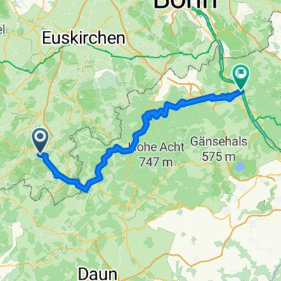
Point of interest after 66 km
Altenahr Altstadt
Point of interest after 76.9 km
Minigolf
Point of interest after 83.8 km
Weinkontor Diedenhofen 630
Continue with Bikemap
Use, edit, or download this cycling route
You would like to ride Ahrtour or customize it for your own trip? Here is what you can do with this Bikemap route:
Free features
- Save this route as favorite or in collections
- Copy & plan your own version of this route
- Split it into stages to create a multi-day tour
- Sync your route with Garmin or Wahoo
Premium features
Free trial for 3 days, or one-time payment. More about Bikemap Premium.
- Navigate this route on iOS & Android
- Export a GPX / KML file of this route
- Create your custom printout (try it for free)
- Download this route for offline navigation
Discover more Premium features.
Get Bikemap PremiumFrom our community
Other popular routes starting in Blankenheim
 9_ Blankenheim bis Kerschenbach
- Distance
- 18.1 km
- Ascent
- 289 m
- Descent
- 241 m
- Location
- Blankenheim, North Rhine-Westphalia, Germany
 Tour de Natur (Nordeifel)
- Distance
- 53.4 km
- Ascent
- 105 m
- Descent
- 484 m
- Location
- Blankenheim, North Rhine-Westphalia, Germany
 18 Ahrtalradroute
- Distance
- 85 km
- Ascent
- 87 m
- Descent
- 519 m
- Location
- Blankenheim, North Rhine-Westphalia, Germany
 Erfttour 2016
- Distance
- 126.9 km
- Ascent
- 80 m
- Descent
- 538 m
- Location
- Blankenheim, North Rhine-Westphalia, Germany
 Ahr Radweg
- Distance
- 80.4 km
- Ascent
- 146 m
- Descent
- 576 m
- Location
- Blankenheim, North Rhine-Westphalia, Germany
 Am Freilinger See nach K69
- Distance
- 19.8 km
- Ascent
- 256 m
- Descent
- 277 m
- Location
- Blankenheim, North Rhine-Westphalia, Germany
 Ahrtour
- Distance
- 83.8 km
- Ascent
- 113 m
- Descent
- 557 m
- Location
- Blankenheim, North Rhine-Westphalia, Germany
 Ahr-Radweg
- Distance
- 131.3 km
- Ascent
- 1,695 m
- Descent
- 2,120 m
- Location
- Blankenheim, North Rhine-Westphalia, Germany
Open it in the app