

blanchet - la goutelle
A cycling route starting in Chapdes-Beaufort, Auvergne-Rhône-Alpes, France.
Overview
About this route
- -:--
- Duration
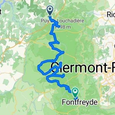
- 12.7 km
- Distance
- 415 m
- Ascent
- 518 m
- Descent
- ---
- Avg. speed
- ---
- Max. altitude
Route highlights
Points of interest along the route
Point of interest after 7.9 km
arret pique nique
Continue with Bikemap
Use, edit, or download this cycling route
You would like to ride blanchet - la goutelle or customize it for your own trip? Here is what you can do with this Bikemap route:
Free features
- Save this route as favorite or in collections
- Copy & plan your own version of this route
- Sync your route with Garmin or Wahoo
Premium features
Free trial for 3 days, or one-time payment. More about Bikemap Premium.
- Navigate this route on iOS & Android
- Export a GPX / KML file of this route
- Create your custom printout (try it for free)
- Download this route for offline navigation
Discover more Premium features.
Get Bikemap PremiumFrom our community
Other popular routes starting in Chapdes-Beaufort
 blanchet - la goutelle
- Distance
- 12.7 km
- Ascent
- 415 m
- Descent
- 518 m
- Location
- Chapdes-Beaufort, Auvergne-Rhône-Alpes, France
 Recovered Route
- Distance
- 6.5 km
- Ascent
- 81 m
- Descent
- 96 m
- Location
- Chapdes-Beaufort, Auvergne-Rhône-Alpes, France
 Chapdes-Beaufort via Trimoulet
- Distance
- 10.9 km
- Ascent
- 231 m
- Descent
- 232 m
- Location
- Chapdes-Beaufort, Auvergne-Rhône-Alpes, France
 De 27 Rue de la Chartreuse, Chapdes-Beaufort à D418, Chapdes-Beaufort
- Distance
- 4.5 km
- Ascent
- 43 m
- Descent
- 122 m
- Location
- Chapdes-Beaufort, Auvergne-Rhône-Alpes, France
 De D418, Chapdes-Beaufort à 9bis Rue de la Chartreuse, Chapdes-Beaufort
- Distance
- 4.4 km
- Ascent
- 131 m
- Descent
- 64 m
- Location
- Chapdes-Beaufort, Auvergne-Rhône-Alpes, France
 Chapdes-Beaufort - Sant Genèst de Champanèla
- Distance
- 62 km
- Ascent
- 1,175 m
- Descent
- 1,126 m
- Location
- Chapdes-Beaufort, Auvergne-Rhône-Alpes, France
 De D418, Chapdes-Beaufort à D418, Chapdes-Beaufort
- Distance
- 1.3 km
- Ascent
- 17 m
- Descent
- 75 m
- Location
- Chapdes-Beaufort, Auvergne-Rhône-Alpes, France
 2017-10-31 15:38:25
- Distance
- 43.9 km
- Ascent
- 692 m
- Descent
- 686 m
- Location
- Chapdes-Beaufort, Auvergne-Rhône-Alpes, France
Open it in the app