

Palling - Tengling MTB
A cycling route starting in Tittmoning, Bavaria, Germany.
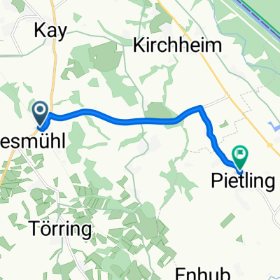
Overview
About this route
- -:--
- Duration
- 49.3 km
- Distance
- 349 m
- Ascent
- 217 m
- Descent
- ---
- Avg. speed
- 574 m
- Max. altitude

Route quality
Waytypes & surfaces along the route
Waytypes
Quiet road
18.7 km
(38 %)
Road
14.8 km
(30 %)
Surfaces
Paved
34.5 km
(70 %)
Unpaved
9.4 km
(19 %)
Asphalt
34.5 km
(70 %)
Unpaved (undefined)
3.9 km
(8 %)
Route highlights
Points of interest along the route
Point of interest after 0 km
Continue with Bikemap
Use, edit, or download this cycling route
You would like to ride Palling - Tengling MTB or customize it for your own trip? Here is what you can do with this Bikemap route:
Free features
- Save this route as favorite or in collections
- Copy & plan your own version of this route
- Sync your route with Garmin or Wahoo
Premium features
Free trial for 3 days, or one-time payment. More about Bikemap Premium.
- Navigate this route on iOS & Android
- Export a GPX / KML file of this route
- Create your custom printout (try it for free)
- Download this route for offline navigation
Discover more Premium features.
Get Bikemap PremiumFrom our community
Other popular routes starting in Tittmoning
 Furth 9, Tittmoning - Salzburg
- Distance
- 22.9 km
- Ascent
- 71 m
- Descent
- 143 m
- Location
- Tittmoning, Bavaria, Germany
 Bahnhof pietling
- Distance
- 5.7 km
- Ascent
- 12 m
- Descent
- 66 m
- Location
- Tittmoning, Bavaria, Germany
 Tittmoning - Schönram - Traunstein
- Distance
- 74.2 km
- Ascent
- 371 m
- Descent
- 246 m
- Location
- Tittmoning, Bavaria, Germany
 Furth 9, Tittmoning - Salzburg
- Distance
- 46.4 km
- Ascent
- 107 m
- Descent
- 148 m
- Location
- Tittmoning, Bavaria, Germany
 Zum Casa Taiola_1
- Distance
- 640.7 km
- Ascent
- 1,319 m
- Descent
- 1,710 m
- Location
- Tittmoning, Bavaria, Germany
 Landshut
- Distance
- 216.2 km
- Ascent
- 498 m
- Descent
- 553 m
- Location
- Tittmoning, Bavaria, Germany
 Windradlrundn 2
- Distance
- 42.2 km
- Ascent
- 361 m
- Descent
- 361 m
- Location
- Tittmoning, Bavaria, Germany
 Asten
Asten- Distance
- 10.7 km
- Ascent
- 34 m
- Descent
- 122 m
- Location
- Tittmoning, Bavaria, Germany
Open it in the app