

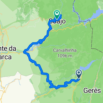
Terras de Bouro nach Arcos de Valdevez
A cycling route starting in Antas, Braga District, Portugal.
Overview
About this route
- 4 h 13 min
- Duration
- 48.1 km
- Distance
- 1,833 m
- Ascent
- 2,131 m
- Descent
- 11.4 km/h
- Avg. speed
- 723 m
- Max. altitude

Route quality
Waytypes & surfaces along the route
Waytypes
Quiet road
16.9 km
(35 %)
Road
15.9 km
(33 %)
Surfaces
Paved
8.7 km
(18 %)
Unpaved
4.8 km
(10 %)
Asphalt
8.7 km
(18 %)
Ground
3.9 km
(8 %)
Continue with Bikemap
Use, edit, or download this cycling route
You would like to ride Terras de Bouro nach Arcos de Valdevez or customize it for your own trip? Here is what you can do with this Bikemap route:
Free features
- Save this route as favorite or in collections
- Copy & plan your own version of this route
- Sync your route with Garmin or Wahoo
Premium features
Free trial for 3 days, or one-time payment. More about Bikemap Premium.
- Navigate this route on iOS & Android
- Export a GPX / KML file of this route
- Create your custom printout (try it for free)
- Download this route for offline navigation
Discover more Premium features.
Get Bikemap PremiumFrom our community
Other popular routes starting in Antas
 Terras de Bouro nach Arcos de Valdevez
- Distance
- 48.1 km
- Ascent
- 1,833 m
- Descent
- 2,131 m
- Location
- Antas, Braga District, Portugal
 Campo - Geraz do Minho
- Distance
- 47.9 km
- Ascent
- 796 m
- Descent
- 1,209 m
- Location
- Antas, Braga District, Portugal
 Portugalsko na kole 03 - 17.9.2013
- Distance
- 68 km
- Ascent
- 1,487 m
- Descent
- 1,487 m
- Location
- Antas, Braga District, Portugal
 grand portugal nord
- Distance
- 179.2 km
- Ascent
- 3,646 m
- Descent
- 3,648 m
- Location
- Antas, Braga District, Portugal
 Campo - Viera
- Distance
- 38.2 km
- Ascent
- 907 m
- Descent
- 1,159 m
- Location
- Antas, Braga District, Portugal
 Campo - Guimaraes
- Distance
- 65.8 km
- Ascent
- 990 m
- Descent
- 1,439 m
- Location
- Antas, Braga District, Portugal
 Caminhada lenta Vila Verde
- Distance
- 12.5 km
- Ascent
- 602 m
- Descent
- 184 m
- Location
- Antas, Braga District, Portugal
 25.Mai Refugio Runde Serra Amarela
- Distance
- 37.1 km
- Ascent
- 904 m
- Descent
- 907 m
- Location
- Antas, Braga District, Portugal
Open it in the app