

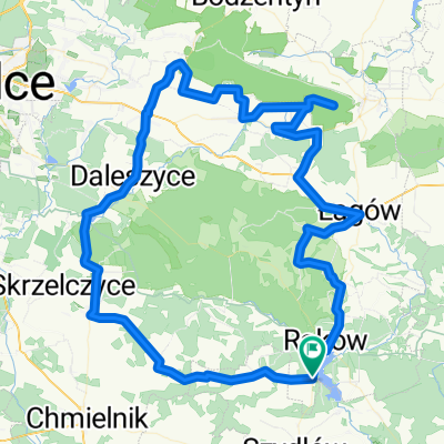
Raków - Święty Krzyż
A cycling route starting in Raków, Świętokrzyskie Voivodship, Poland.
Overview
About this route
- 1 h 49 min
- Duration
- 31.2 km
- Distance
- 617 m
- Ascent
- 258 m
- Descent
- 17.2 km/h
- Avg. speed
- 596 m
- Max. altitude
Route quality
Waytypes & surfaces along the route
Waytypes
Quiet road
10.4 km
(33 %)
Road
4.9 km
(16 %)
Surfaces
Paved
29.6 km
(95 %)
Unpaved
0.2 km
(<1 %)
Asphalt
29.6 km
(95 %)
Unpaved (undefined)
0.2 km
(<1 %)
Continue with Bikemap
Use, edit, or download this cycling route
You would like to ride Raków - Święty Krzyż or customize it for your own trip? Here is what you can do with this Bikemap route:
Free features
- Save this route as favorite or in collections
- Copy & plan your own version of this route
- Sync your route with Garmin or Wahoo
Premium features
Free trial for 3 days, or one-time payment. More about Bikemap Premium.
- Navigate this route on iOS & Android
- Export a GPX / KML file of this route
- Create your custom printout (try it for free)
- Download this route for offline navigation
Discover more Premium features.
Get Bikemap PremiumFrom our community
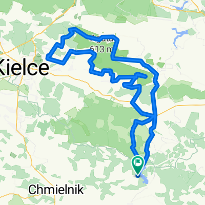
Other popular routes starting in Raków
 trasa 2 Ogólnopolski Majowy Rajd Świętokrzyski
- Distance
- 53.4 km
- Ascent
- 626 m
- Descent
- 586 m
- Location
- Raków, Świętokrzyskie Voivodship, Poland
 Raków - Bardo - Raków
- Distance
- 21.6 km
- Ascent
- 185 m
- Descent
- 181 m
- Location
- Raków, Świętokrzyskie Voivodship, Poland
 iwaniska - włostów
- Distance
- 98.4 km
- Ascent
- 457 m
- Descent
- 461 m
- Location
- Raków, Świętokrzyskie Voivodship, Poland
 życiny-łagów-św.K.-klonów - pętla duża
- Distance
- 145.4 km
- Ascent
- 1,097 m
- Descent
- 1,097 m
- Location
- Raków, Świętokrzyskie Voivodship, Poland
 Okolice Rakowa
- Distance
- 387.2 km
- Ascent
- 2,664 m
- Descent
- 2,665 m
- Location
- Raków, Świętokrzyskie Voivodship, Poland
 7_2021_Chańcza_Kielce
- Distance
- 59.4 km
- Ascent
- 264 m
- Descent
- 228 m
- Location
- Raków, Świętokrzyskie Voivodship, Poland
 pętla Życiny-Daleszyce-Św.K.-Łagów.
- Distance
- 113.1 km
- Ascent
- 867 m
- Descent
- 867 m
- Location
- Raków, Świętokrzyskie Voivodship, Poland
 GV 8 - Dzień 3: Chańcza - Kielce.
- Distance
- 74.6 km
- Ascent
- 576 m
- Descent
- 537 m
- Location
- Raków, Świętokrzyskie Voivodship, Poland
Open it in the app